
生物多样性 ›› 2024, Vol. 32 ›› Issue (3): 23381. DOI: 10.17520/biods.2023381 cstr: 32101.14.biods.2023381
万凤鸣1,2, 万华伟2,*( ), 张志如2, 高吉喜2,*(), 孙晨曦2, 王永财3
收稿日期:2023-10-13
接受日期:2023-12-25
出版日期:2024-03-20
发布日期:2024-03-06
通讯作者:
*E-mail: livelyhw@163.com;
gjx@nies.org
基金资助:
Fengming Wan1,2, Huawei Wan2,*(), Zhiru Zhang2, Jixi Gao2,*(), Chenxi Sun2, Yongcai Wang3
Received:2023-10-13
Accepted:2023-12-25
Online:2024-03-20
Published:2024-03-06
Contact:
*E-mail: livelyhw@163.com;
gjx@nies.org
摘要:
草地生物多样性对于维持其生态系统服务功能至关重要, 无人机遥感凭借机动灵活、高分辨率、高效率和低成本的优势, 近年来在草地物种调查与研究中受到关注。然而, 目前关于草地植物多样性无人机调查的研究仍然不够深入。本研究通过无人机航拍和人工地面调查对呼伦贝尔草甸草原区的植物多样性进行调查, 通过比较不同样方布设方式、不同拍摄方式下观测到的物种数量和调查所用时间, 探讨扩大调查面积对调查结果的影响以及利用无人机开展草地植物多样性调查的最佳拍摄参数和时间效率, 分析草地植物多样性无人机调查的应用潜力。结果表明: (1)开展草地植物多样性调查时, 物种数量随调查面积在一定范围内的增加而增多, 与人工调查有限个样方相比, 利用无人机进行大面积调查能够观测到更多的物种。(2)在半干旱地区草甸草原植物多样性调查中, 用于物种识别的无人机RGB影像空间分辨率应优于0.45 mm, 分辨率为0.45 mm时能识别67.16%的物种; 在观测角度方面, 采用两种方式进行拍摄为佳, 可在90°垂直拍摄基础上增加45°或60°倾斜拍摄。(3)采用无人机调查可大幅缩短物种调查所用时间, 但应配合高精度的物种智能识别模型以提高调查效率。本研究通过对比无人机与传统的人工地面调查观测到的物种数量, 进一步验证了无人机遥感用于草地植物多样性调查的可行性, 首次探讨了利用无人机获取可见光影像用于草地物种调查时的关键参数, 研究结果可推动无人机在草地监测、调查和保护工作中的应用。
万凤鸣, 万华伟, 张志如, 高吉喜, 孙晨曦, 王永财 (2024) 草地植物多样性无人机调查的应用潜力. 生物多样性, 32, 23381. DOI: 10.17520/biods.2023381.
Fengming Wan, Huawei Wan, Zhiru Zhang, Jixi Gao, Chenxi Sun, Yongcai Wang (2024) The application potential of unmanned aerial vehicle surveys in grassland plant diversity. Biodiversity Science, 32, 23381. DOI: 10.17520/biods.2023381.
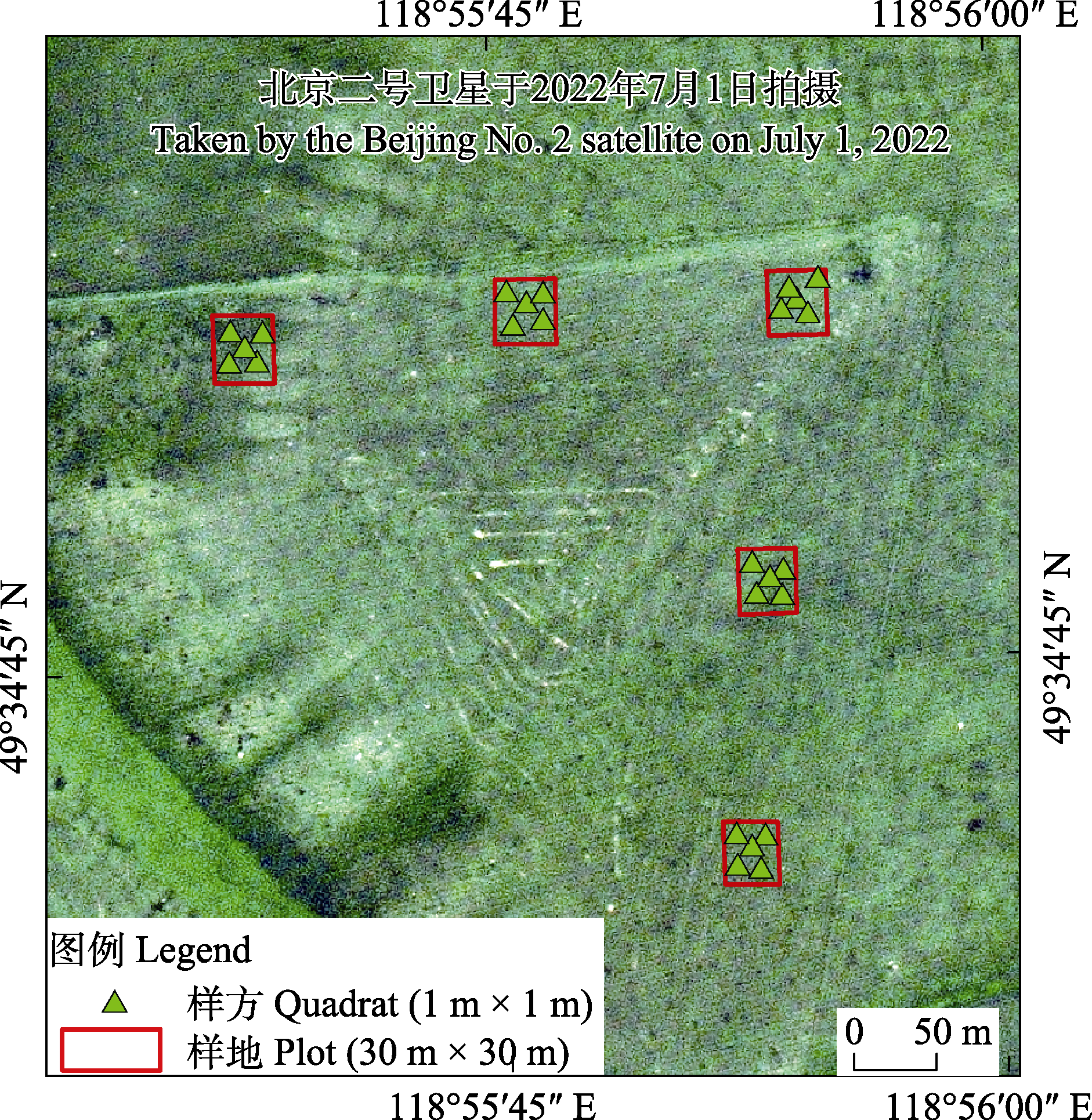
图1 研究区位置及样地样方分布
Fig. 1 The location of the study area and the distribution of the quadrats
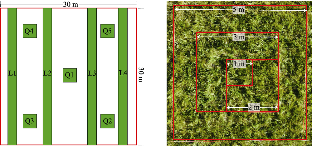
图2 样方与样线的相对位置(a)及嵌套样方(b)示意图。Q: 样方, 1 m × 1 m; L: 样线, 30 m × 1 m。
Fig. 2 Relative position of the quadrat and the line transect (a) and the diagram of nested quadrat (b). Q, Quadrat, 1 m × 1 m; L, Line transect, 30 m × 1 m.
| 照片采集设备 Photo acquisition equipment | 采集对象 Sampling objects | 飞行高度 Flight height (m) | 拍摄角度 Angle of photography | 90°拍摄时空间分辨率 Vertical shooting spatial resolution (mm) | 备注 Remarks |
|---|---|---|---|---|---|
| DJI Mini 3 Pro | 30 m × 1 m样线 30 m × 1 m line transect | 1 | 30°、45°、60°、75°、90° | 0.43 | |
| 2 | 30°、45°、60°、75°、90° | 0.88 | |||
| DJI Mavic 2 Pro | 30 m × 1 m样线 30 m × 1 m line transect | 1.5 | 30°、45°、60°、75°、90° | 0.38 | |
| 3 | 30°、45°、60°、75°、90° | 0.77 | |||
| DJI Matrice 300 RTK + AQ600 | 1 m × 1 m样方 1 m × 1 m quadrat | 2 | 90° | 0.45 | |
| 3 | 90° | 0.65 | |||
| 4 | 90° | 0.90 | |||
| 5 | 90° | 1.10 | |||
| 6 | 90° | 1.35 | |||
| DJI Matrice 300 RTK + H20 | 30 m × 1 m样线 30 m × 1 m line transect | - | 45°、60°、75°、90° | 1.00 | 变焦相机, 固定分辨率拍摄 Zoom camera, fixed resolution shooting |
| - | 45°、60°、75°、90° | 2.00 | |||
| 5 | 90° | 0.20 |
表1 无人机航拍采集参数
Table 1 Unmanned aerial vehicle (UAV) aerial photography acquisition parameters
| 照片采集设备 Photo acquisition equipment | 采集对象 Sampling objects | 飞行高度 Flight height (m) | 拍摄角度 Angle of photography | 90°拍摄时空间分辨率 Vertical shooting spatial resolution (mm) | 备注 Remarks |
|---|---|---|---|---|---|
| DJI Mini 3 Pro | 30 m × 1 m样线 30 m × 1 m line transect | 1 | 30°、45°、60°、75°、90° | 0.43 | |
| 2 | 30°、45°、60°、75°、90° | 0.88 | |||
| DJI Mavic 2 Pro | 30 m × 1 m样线 30 m × 1 m line transect | 1.5 | 30°、45°、60°、75°、90° | 0.38 | |
| 3 | 30°、45°、60°、75°、90° | 0.77 | |||
| DJI Matrice 300 RTK + AQ600 | 1 m × 1 m样方 1 m × 1 m quadrat | 2 | 90° | 0.45 | |
| 3 | 90° | 0.65 | |||
| 4 | 90° | 0.90 | |||
| 5 | 90° | 1.10 | |||
| 6 | 90° | 1.35 | |||
| DJI Matrice 300 RTK + H20 | 30 m × 1 m样线 30 m × 1 m line transect | - | 45°、60°、75°、90° | 1.00 | 变焦相机, 固定分辨率拍摄 Zoom camera, fixed resolution shooting |
| - | 45°、60°、75°、90° | 2.00 | |||
| 5 | 90° | 0.20 |
| 调查方式 Survey method | 实际调查面积 Actual survey area (m2) | 调查代表的区域面积 The area represented by the survey (m2) | 物种数 No. of species |
|---|---|---|---|
| 嵌套样方 Nested quadrats | 1 | - | 19 |
| 4 | - | 26 | |
| 9 | - | 33 | |
| 25 | - | 39 | |
| 不同数量样方 Different number of quadrats | 1 | 900 | 20.8 |
| 3 | 900 | 33.6 | |
| 5 | 900 | 39.4 | |
| 不同数量样地 Different number of plots | 125 | 250,000 | 49.6 |
| 250 | 250,000 | 62.7 | |
| 375 | 250,000 | 69.3 | |
| 500 | 250,000 | 74.0 | |
| 625 | 250,000 | 77 | |
| 增加样线 Add line transects | 120 | 900 | 10.2 |
| 600 | 250,000 | 10 |
表2 不同调查方式调查到的物种数
Table 2 No. of species investigated by different survey methods
| 调查方式 Survey method | 实际调查面积 Actual survey area (m2) | 调查代表的区域面积 The area represented by the survey (m2) | 物种数 No. of species |
|---|---|---|---|
| 嵌套样方 Nested quadrats | 1 | - | 19 |
| 4 | - | 26 | |
| 9 | - | 33 | |
| 25 | - | 39 | |
| 不同数量样方 Different number of quadrats | 1 | 900 | 20.8 |
| 3 | 900 | 33.6 | |
| 5 | 900 | 39.4 | |
| 不同数量样地 Different number of plots | 125 | 250,000 | 49.6 |
| 250 | 250,000 | 62.7 | |
| 375 | 250,000 | 69.3 | |
| 500 | 250,000 | 74.0 | |
| 625 | 250,000 | 77 | |
| 增加样线 Add line transects | 120 | 900 | 10.2 |
| 600 | 250,000 | 10 |
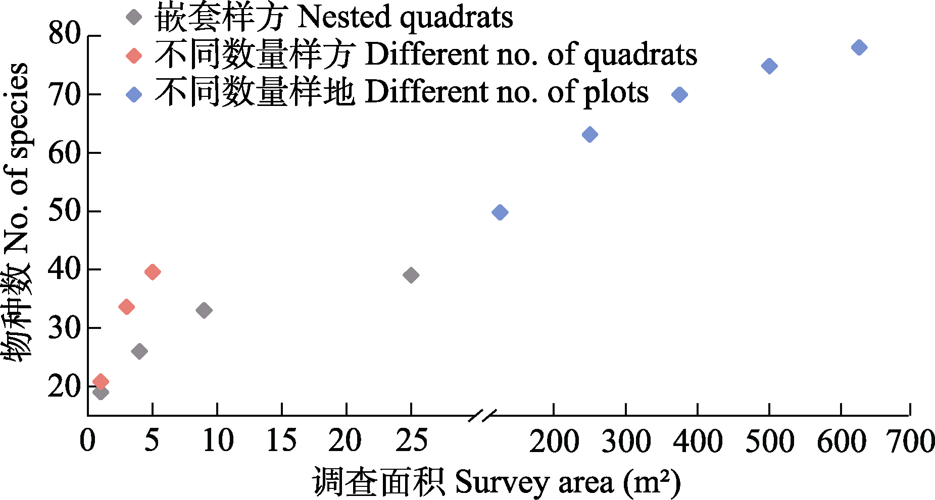
图3 不同调查方式调查到的物种数散点图
Fig. 3 Scatter plots of species investigated by different survey methods
| 飞行高度 Flight height | 拍摄角度 Angle of photography | ||||
|---|---|---|---|---|---|
| 30° | 45° | 60° | 75° | 90° | |
| 1 m |  |  |  |  |  |
| 2 m |  |  |  |  |  |
表3 不同飞行高度与角度下航拍图像对比
Table 3 Comparison of aerial images at different flight heights and angles
| 飞行高度 Flight height | 拍摄角度 Angle of photography | ||||
|---|---|---|---|---|---|
| 30° | 45° | 60° | 75° | 90° | |
| 1 m | | | | | |
| 2 m | | | | | |
| 飞行高度 Flight height (m) | |||||
|---|---|---|---|---|---|
| 2 | 3 | 4 | 5 | 6 | |
| 空间分辨率 Spatial resolution (mm) | 0.45 | 0.65 | 0.90 | 1.10 | 1.35 |
| 影像 Image | 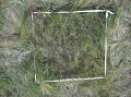 | 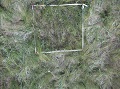 | 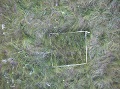 | 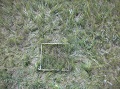 | 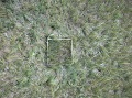 |
| 物种识别率 Species recognition rates (%) | 67.16 | 59.70 | 55.22 | 49.25 | 43.28 |
表4 不同空间分辨率无人机影像的物种识别率
Table 4 Species recognition rates from unmanned aerial vehicle (UAV) images with different spatial resolutions
| 飞行高度 Flight height (m) | |||||
|---|---|---|---|---|---|
| 2 | 3 | 4 | 5 | 6 | |
| 空间分辨率 Spatial resolution (mm) | 0.45 | 0.65 | 0.90 | 1.10 | 1.35 |
| 影像 Image | | | | | |
| 物种识别率 Species recognition rates (%) | 67.16 | 59.70 | 55.22 | 49.25 | 43.28 |
| 调查方式 Survey method | 调查对象 Survey respondents | 调查用时 Time of survey (min) |
|---|---|---|
| 人工地面调查 Artificial ground survey | 1 m × 1 m 样方 1 m × 1 m quadrat | 10 |
| 2 m × 2 m 样方 2 m × 2 m quadrat | 18 | |
| 3 m × 3 m 样方 3 m × 3 m quadrat | 28.5 | |
| 5 m × 5 m 样方 5 m × 5 m quadrat | 46.5 | |
| 30 m × 1 m 样线 30 m × 1 m line transect | 10* | |
| 无人机调查 UAV survey | 1 m × 1 m 样方 1 m × 1 m quadrat | 0.28 |
| 30 m × 1 m 样线 30 m × 1 m line transect | 1.05 |
表5 不同调查方式用时
Table 5 Time of different survey methods
| 调查方式 Survey method | 调查对象 Survey respondents | 调查用时 Time of survey (min) |
|---|---|---|
| 人工地面调查 Artificial ground survey | 1 m × 1 m 样方 1 m × 1 m quadrat | 10 |
| 2 m × 2 m 样方 2 m × 2 m quadrat | 18 | |
| 3 m × 3 m 样方 3 m × 3 m quadrat | 28.5 | |
| 5 m × 5 m 样方 5 m × 5 m quadrat | 46.5 | |
| 30 m × 1 m 样线 30 m × 1 m line transect | 10* | |
| 无人机调查 UAV survey | 1 m × 1 m 样方 1 m × 1 m quadrat | 0.28 |
| 30 m × 1 m 样线 30 m × 1 m line transect | 1.05 |
| [1] | Abdel-Rahman E, Makori D, Landmann T, Piiroinen R, Gasim S, Pellikka P, Raina S (2015) The utility of AISA eagle hyperspectral data and random forest classifier for flower mapping. Remote Sensing, 7, 13298-13318. |
| [2] | Alvarez-Vanhard E, Houet T, Mony C, Lecoq L, Corpetti T (2020) Can UAVs fill the gap between in situ surveys and satellites for habitat mapping? Remote Sensing of Environment, 243, 111780. |
| [3] | Alves Oliveira R, Marcato J Jr, Soares Costa C, Näsi R, Koivumäki N, Niemeläinen O, Kaivosoja J, Nyholm L, Pistori H, Honkavaara E (2022) CNN based automated weed detection system using UAV imagery. Silage grass sward nitrogen concentration and dry matter yield estimation using deep regression and RGB images captured by UAV. Agronomy, 12, 1352. |
| [4] | Anul Haq M (2022) CNN based automated weed detection system using UAV imagery. Computer Systems Science and Engineering, 42, 837-849. |
| [5] | Delectis Florae Reipublicae Popularis Sinicae Agendae Academiae Sinicae Edita (1959-2004) Flora Reipublicae Popularis Sinicae (Tomus 1-80). Science Press, Beijing. (in Chinese) |
| [ 中国科学院中国植物志编辑委员会 (1959-2004) 中国植物志(第1-80卷). 科学出版社, 北京.] | |
| [6] |
Fang JY, Wang XP, Shen ZH, Tang ZY, He JS, Yu D, Jiang Y, Wang ZH, Zheng CY, Zhu JL, Guo ZD (2009) Methods and protocols for plant community inventory. Biodiversity Science, 17, 533-548. (in Chinese with English abstract)
DOI |
|
[ 方精云, 王襄平, 沈泽昊, 唐志尧, 贺金生, 于丹, 江源, 王志恒, 郑成洋, 朱江玲, 郭兆迪 (2009) 植物群落清查的主要内容、方法和技术规范. 生物多样性, 17, 533-548.]
DOI |
|
| [7] | Gallmann J, Schüpbach B, Jacot K, Albrecht M, Winizki J, Kirchgessner N, Aasen H (2022) Flower mapping in grasslands with drones and deep learning. Frontiers in Plant Science, 12, 774965. |
| [8] |
Gao JT, Sun FD, Huo F, Zhang LB, Zhou S, Yang TY, Bianbazhaxi (2021) Application and evaluation of unmanned aerial vehicle remote sensing in grassland animal and plant monitoring. Acta Agrestia Sinica, 29, 1-9. (in Chinese with English abstract)
DOI |
|
[ 高娟婷, 孙飞达, 霍霏, 张履冰, 周俗, 杨廷勇, 边巴扎西 (2021) 无人机遥感技术在草地动植物调查监测中的应用与评价. 草地学报, 29, 1-9.]
DOI |
|
| [9] | Gómez-Candón D, De Castro AI, López-Granados F (2014) Assessing the accuracy of mosaics from unmanned aerial vehicle (UAV) imagery for precision agriculture purposes in wheat. Precision Agriculture, 15, 44-56. |
| [10] |
Guo K, Liu CC, Pan QM (2016) Methods of observing typical plant communities in the Steppe and Desert Biodiversity Observation Network, Sino BON. Biodiversity Science, 24, 1220-1226. (in Chinese with English abstract)
DOI |
|
[ 郭柯, 刘长成, 潘庆民 (2016) 中国草原/荒漠植物多样性监测网模式植物群落监测方案. 生物多样性, 24, 1220-1226.]
DOI |
|
| [11] | Hautier Y, Isbell F, Borer ET, Seabloom EW, Harpole WS, Lind EM, MacDougall AS, Stevens CJ, Adler PB, Alberti J, Bakker JD, Brudvig LA, Buckley YM, Cadotte M, Caldeira MC, Chaneton EJ, Chu CJ, Daleo P, Dickman CR, Dwyer JM, Eskelinen A, Fay PA, Firn J, Hagenah N, Hillebrand H, Iribarne O, Kirkman KP, Knops JMH, La Pierre KJ, McCulley RL, Morgan JW, Pärtel M, Pascual J, Price JN, Prober SM, Risch AC, Sankaran M, Schuetz M, Standish RJ, Virtanen R, Wardle GM, Yahdjian L, Hector A (2018) Local loss and spatial homogenization of plant diversity reduce ecosystem multifunctionality. Nature Ecology & Evolution, 2, 50-56. |
| [12] | Hill DJ, Tarasoff C, Whitworth GE, Baron J, Bradshaw JL, Church JS (2016) Utility of unmanned aerial vehicles for mapping invasive plant species: A case study on yellow flag iris (Iris pseudacorus L.). International Journal of Remote Sensing, 38, 2083-2105. |
| [13] | Hung C, Xu Z, Sukkarieh S (2014) Feature learning based approach for weed classification using high resolution aerial images from a digital camera mounted on a UAV. Remote Sensing, 6, 12037-12054. |
| [14] | Jackson J, Lawson CS, Adelmant C, Huhtala E, Fernandes P, Hodgson R, King H, Williamson L, Maseyk K, Hawes N, Hector A, Salguero-Gómez R (2022) Short-range multispectral imaging is an inexpensive, fast, and accurate approach to estimate biodiversity in a temperate calcareous grassland. Ecology and Evolution, 12, e9623. |
| [15] | Jin XL, Liu SY, Baret F, Hemerlé M, Comar A (2017) Estimates of plant density of wheat crops at emergence from very low altitude UAV imagery. Remote Sensing of Environment, 198, 105-114. |
| [16] |
Kattenborn T, Eichel J, Fassnacht FE (2019) Convolutional neural networks enable efficient, accurate and fine-grained segmentation of plant species and communities from high-resolution UAV imagery. Scientific Reports, 9, 17656.
DOI PMID |
| [17] | Landmann T, Piiroinen R, Makori DM, Abdel-Rahman EM, Makau S, Pellikka P, Raina SK (2015) Application of hyperspectral remote sensing for flower mapping in African savannas. Remote Sensing of Environment, 166, 50-60. |
| [18] | López-Granados F, Torres-Sánchez J, De Castro AI, Serrano-Pérez A, Mesas-Carrascosa FJ, Peña JM (2016) Object-based early monitoring of a grass weed in a grass crop using high resolution UAV imagery. Agronomy for Sustainable Development, 36, 67. |
| [19] | Lyu X, Li XB, Dang DL, Dou HS, Wang K, Lou AR (2022) Unmanned aerial vehicle (UAV) remote sensing in grassland ecosystem monitoring: A systematic review. Remote Sensing, 14, 1096. |
| [20] | Mantyka-Pringle CS, Visconti P, Di Marco M, Martin TG, Rondinini C, Rhodes JR (2015) Climate change modifies risk of global biodiversity loss due to land-cover change. Biological Conservation, 187, 103-111. |
| [21] | Martin FM, Müllerová J, Borgniet L, Dommanget F, Breton V, Evette A (2018) Using single- and multi-date UAV and satellite imagery to accurately monitor invasive knotweed species. Remote Sensing, 10, 1662. |
| [22] |
Müllerová J, Brůna J, Bartaloš T, Dvořák P, Vítková M, Pyšek P (2017) Timing is important: Unmanned aircraft vs. satellite imagery in plant invasion monitoring. Frontiers in Plant Science, 8, 887.
DOI PMID |
| [23] | Polley H, Yang CH, Wilsey B, Fay P (2019) Spectral heterogeneity predicts local-scale gamma and beta diversity of mesic grasslands. Remote Sensing, 11, 458. |
| [24] | Qian DW, Du YG, Li Q, Guo XW, Fan B, Cao GM (2022) Impacts of alpine shrub-meadow degradation on its ecosystem services and spatial patterns in Qinghai-Tibetan Plateau. Ecological Indicators, 135, 108541. |
| [25] | Qin Y, Sun Y, Zhang W, Qin Y, Chen JJ, Wang ZW, Zhou ZY (2020) Species monitoring using unmanned aerial vehicle to reveal the ecological role of plateau pika in maintaining vegetation diversity on the Northeastern Qinghai-Tibetan Plateau. Remote Sensing, 12, 2480. |
| [26] | Rossi C, Kneubühler M, Schütz M, Schaepman ME, Haller RM, Risch AC, Disney M, He K (2022) Spatial resolution, spectral metrics and biomass are key aspects in estimating plant species richness from spectral diversity in species-rich grasslands. Remote Sensing in Ecology and Conservation, 8, 297-314. |
| [27] |
Sun Y, Qin Y, Wei TF, Chang L, Zhang RP, Liu ZY, Lyu YY, Yi SH (2022) Methods and development trend for the measurement of plant species diversity in grasslands. Chinese Journal of Applied Ecology, 33, 655-663. (in Chinese with English abstract)
DOI |
|
[ 孙义, 秦彧, 魏天锋, 常丽, 张仁平, 刘志有, 吕燕燕, 宜树华 (2022) 草地植物物种多样性测度方法及发展趋势. 应用生态学报, 33, 655-663.]
DOI |
|
| [28] | Sun Y, Yi SH, Hou FJ (2018) Unmanned aerial vehicle methods makes species composition monitoring easier in grasslands. Ecological Indicators, 95, 825-830. |
| [29] | Sun Y, Yuan YX, Luo Y, Ji WX, Bian QY, Zhu ZQ, Wang JR, Qin Y, He XZ, Li M, Yi SH (2022) An improved method for monitoring multiscale plant species diversity of alpine grassland using UAV: A case study in the source region of the Yellow River, China. Frontiers in Plant Science, 13, 905715. |
| [30] | Tang ZY, Qiao XJ, Fang JY (2009) Species-area relationship in biological communities. Biodiversity Science, 17, 549-559. (in Chinese with English abstract) |
|
[ 唐志尧, 乔秀娟, 方精云 (2009) 生物群落的种-面积关系. 生物多样性, 17, 549-559.]
DOI |
|
| [31] | Villoslada M, Bergamo TF, Ward RD, Burnside NG, Joyce CB, Bunce RGH, Sepp K (2020) Fine scale plant community assessment in coastal meadows using UAV based multispectral data. Ecological Indicators, 111, 105979. |
| [32] | Wei TF, Shangguan DH, Yi SH, Ding YJ (2021) Characteristics and controls of vegetation and diversity changes monitored with an unmanned aerial vehicle (UAV) in the foreland of the Urumqi Glacier No. 1, Tianshan, China. Science of the Total Environment, 771, 145433. |
| [33] | White TB, Viana LR, Campbell G, Elverum C, Bennun LA (2021) Using technology to improve the management of development impacts on biodiversity. Business Strategy and the Environment, 30, 3502-3516. |
| [34] | Wijesingha J, Astor T, Schulze-Brüninghoff D, Wachendorf M (2020) Mapping invasive Lupinus polyphyllus Lindl. in semi-natural grasslands using object-based image analysis of UAV-borne images. PFG-Journal of Photogrammetry, Remote Sensing and Geoinformation Science, 88, 391-406. |
| [35] | Zhang X, Bao YH, Wang DL, Xin XP, Ding L, Xu DW, Hou LL, Shen J (2021) Using UAV LiDAR to extract vegetation parameters of Inner Mongolian grassland. Remote Sensing, 13, 656. |
| [36] | Zhang XL, Dong SK, Guo XD, Han YH, Li HM, Feng J, Wang C, Liu QR (2015) Comparison of different sampling techniques for alpine grassland plant diversity on Qinghai-Tibet Plateau. Chinese Journal of Ecology, 34, 3568-3574. (in Chinese with English abstract) |
| [ 张晓蕾, 董世魁, 郭贤达, 韩雨晖, 李灏漫, 冯憬, 王琛, 刘全儒 (2015) 青藏高原高寒草地植物多样性调查方法的比较. 生态学杂志, 34, 3568-3574.] | |
| [37] | Zhao YJ, Sun YH, Chen WH, Zhao YP, Liu XL, Bai YF (2021) The potential of mapping grassland plant diversity with the links among spectral diversity, functional trait diversity, and species diversity. Remote Sensing, 13, 3034. |
| [38] | Zheng HB, Zhou X, He JY, Yao X, Cheng T, Zhu Y, Cao WX, Tian YC (2020) Early season detection of rice plants using RGB, NIR-G-B and multispectral images from unmanned aerial vehicle (UAV). Computers and Electronics in Agriculture, 169, 105223. |
| [1] | 石亚飞, 牛富荣, 黄晓敏, 洪星, 龚相文, 王艳莉, 林栋, 柳小妮. 可解释机器学习及其生态学应用[J]. 生物多样性, 2026, 34(1): 25210-. |
| [2] | 李帅, 刘卫华, 许驭丹, 田晓波, 宋厚娟, 岳晓婷, 武玲玲, 张青, 上官铁梁. 山西省野生维管植物编目和分布数据集[J]. 生物多样性, 2025, 33(7): 24317-. |
| [3] | 林秦文, 张娜, 王强. 中国盐生植物编目和分布数据集[J]. 生物多样性, 2025, 33(7): 25030-. |
| [4] | 杨泉峰, 唐艳杰, 肖海军, 王颖, 张蓉, 欧阳芳, 魏淑花. 宁夏不同草原类型植物多样性-蝗虫-步甲的级联效应及对初级生产力的影响[J]. 生物多样性, 2025, 33(6): 25021-. |
| [5] | 袁敬毅, 张旭, 田镇朋, 王梓柘, 高永萍, 姚迪昭, 关宏灿, 李文楷, 刘婧, 张宏, 马勤. 结合无人机高分辨率可见光影像和激光雷达点云的城市植物群落树种组成和数量特征提取方法对比[J]. 生物多样性, 2025, 33(4): 24237-. |
| [6] | 宋威, 程才, 王嘉伟, 吴纪华. 土壤微生物对植物多样性-生态系统功能关系的调控作用[J]. 生物多样性, 2025, 33(4): 24579-. |
| [7] | 张浩斌, 肖路, 刘艳杰. 夜间灯光对外来入侵植物和本地植物群落多样性和生长的影响[J]. 生物多样性, 2025, 33(4): 24553-. |
| [8] | 谢淦, 宣晶, 付其迪, 魏泽, 薛凯, 雒海瑞, 高吉喜, 李敏. 草地植物多样性无人机调查的物种智能识别模型构建[J]. 生物多样性, 2025, 33(4): 24236-. |
| [9] | 吴昱萱, 王平, 胡晓生, 丁一, 彭甜恬, 植秋滢, 巴德木其其格, 李文杰, 关潇, 李俊生. 呼伦贝尔草地退化现状评估与植被特征变化[J]. 生物多样性, 2025, 33(2): 24118-. |
| [10] | 卢炜煜, 陈旭, 张日谦, 张云海, 李昭. 氮和牛粪输入对典型草原植物种-面积关系的影响[J]. 生物多样性, 2025, 33(12): 25251-. |
| [11] | 李东红, 郝媛媛, 甘辉林, 张航, 刘耀猛, 他富源, 胡桂馨. 祁连山北麓中段不同类型草地蝗虫种类及分布[J]. 生物多样性, 2024, 32(9): 24119-. |
| [12] | 连佳丽, 陈婧, 杨雪琴, 赵莹, 罗叙, 韩翠, 赵雅欣, 李建平. 荒漠草原植物多样性和微生物多样性对降水变化的响应[J]. 生物多样性, 2024, 32(6): 24044-. |
| [13] | 王永财, 万华伟, 高吉喜, 胡卓玮, 孙晨曦, 吕娜, 张志如. 基于深度学习的我国北方常见天然草地植物识别[J]. 生物多样性, 2024, 32(4): 23435-. |
| [14] | 张乃鹏, 梁洪儒, 张焱, 孙超, 陈勇, 王路路, 夏江宝, 高芳磊. 土壤类型和地下水埋深对黄河三角洲典型盐沼植物群落空间分异的影响[J]. 生物多样性, 2024, 32(2): 23370-. |
| [15] | 蒋陈焜, 郁文彬, 饶广远, 黎怀成, Julien B. Bachelier, Hartmut H. Hilger, Theodor C. H. Cole. 植物系统发生海报——以演化视角介绍植物多样性的科教资料项目[J]. 生物多样性, 2024, 32(11): 24210-. |
| 阅读次数 | ||||||
|
全文 |
|
|||||
|
摘要 |
|
|||||
备案号:京ICP备16067583号-7
Copyright © 2026 版权所有 《生物多样性》编辑部
地址: 北京香山南辛村20号, 邮编:100093
电话: 010-62836137, 62836665 E-mail: biodiversity@ibcas.ac.cn
![]()