


滨海湿地地处海陆交界的过渡地带, 兼有陆地和水域生态系统的双重特点, 是生产力最高的生态系统之一。凭借其独特的结构和功能, 滨海湿地在调节气候、固碳减排、净化水体、保护生物多样性和维持生态系统平衡等方面均起着重要作用(Barbier et al, 1997)。近年来, 受高强度人类活动与全球生态环境变化的影响, 滨海湿地已成为最脆弱的生态系统之一(骆永明, 2016)。不同的滨海湿地植物物种占据不同的生态位。植物物种类型与分布的改变可直接反映外界环境的变化, 并对滨海湿地生态系统的功能价值以及物质循环与能量流动具有决定性作用(贾庆宇等, 2006; Wan et al, 2019)。目前, 在城市扩张、水体污染、围填海工程规模扩大、外来物种入侵以及海洋资源过度开发等多重影响下, 滨海湿地植物物种面积与数量减少、生产力降低、生态功能退化等多种问题日益突出(路春燕等, 2021), 滨海地区的生态安全与社会经济发展面临严峻挑战。因此, 加强滨海湿地植物物种的保护与管理对维持滨海地区生物多样性和生态可持续发展均具有重要意义。
快速准确识别滨海湿地植物物种类型及其分布是实现滨海湿地精细化生物多样性监测与保护管理的前提和基础(孔嘉鑫等, 2019; 路春燕等, 2021)。遥感技术具有大面积同步成像、信息丰富、无损监测的优势(孙伟伟等, 2020), 可以有效解决滨海湿地腹地区域人员难以进入和现场监测困难等问题, 是目前滨海湿地植物多样性监测的重要手段(郭庆华和刘瑾, 2018; 陈琛等, 2019)。目前, 利用遥感影像进行滨海湿地植物物种分类的方法, 按照处理单元可分为基于像素的分类方法和面向对象的分类方法。基于像素的分类方法多以机器学习分类方法进行研究。例如, 宋怀荣等(2021)以Landsat TM/OLI影像为基本数据源, 利用最大似然法、CART决策树(classification and regression tree)和随机森林(random forest, RF) 3种基于像素的分类方法对江苏盐城国家级珍禽自然保护区核心区的湿地植物物种进行信息提取, 发现随机森林、决策树和最大似然法的总体精确度分别为91.02%、90.23%和89.06%。刘瑞清等(2021)基于Sentinel-2A/B影像, 结合像素级物候特征数据与随机森林方法对盐城滨海湿地进行植物物种分类, 总体精度为87.6%, 较常规单时相分类精度提高19.57%。尽管这些方法已取得较好的成果, 但由于“同物异谱”和“同谱异物”的影响, 基于像素的分类方法在进行遥感影像分类时易出现“椒盐”现象。相对于中低分辨率影像, 高分辨率影像分类时该问题更为突出(聂倩等, 2021)。
相对于基于像素的分类方法, 面向对象的分类方法以具有相同特征像元组成的同质对象为分类单元, 且在分类过程中充分考虑地物的光谱、纹理以及形状等特征, 分类结果可避免“椒盐”现象, 整体性良好(刘润红等, 2017)。例如, 刘凯等(2019)在基于面向对象分割的基础上, 选用K最近邻(K-nearest neighbor, KNN)与随机森林方法对广东珠海淇澳岛红树林实施树种尺度分类, 结果显示面向对象的随机森林的分类精度(89.3%)优于面向对象的K最近邻法(79.7%), 且分类结果整体性好, 无“椒盐”噪声。尽管如此, 由于面向对象的分类方法在分类过程中仅应用影像的低层次特征, 因此当植物物种类型较多时难以得到较高分类精度。随着人工智能、图像模式识别与处理技术的发展, 具有高效降维和高层次特征提取能力的深度学习算法已被初步应用于滨海湿地植物物种分类中(徐岩等, 2021)。如Pashaei等(2020)以无人机影像为数据源, 利用多种深度学习方法对美国德克萨斯湾海岸南部的滨海湿地红树林进行信息提取, 结果发现虽然应用深度学习可获得较高的分类精度, 但分类结果无法完全避免“椒盐”噪声。而结合面向对象与深度学习方法对滨海湿地植物物种进行分类, 不仅可使分类结果避免“椒盐”现象, 同时还能提高特征提取和降维的能力。但在以往的研究中, 综合利用面向对象与深度学习方法对植物物种分类的研究却鲜有报道。
滨海地区易受云雨天气影响, 基于光学卫星的遥感技术因获取时间不够灵活, 难以根据时间要求获取高质量影像; 商业光学卫星影像虽可按要求编程获取影像, 且影像分辨率较高, 但费用较高。雷达遥感影像可有效避免云雨天气的影响, 但其数据易存在噪声, 且数据处理难度大、数据获取费用高。相比而言, 无人机遥感具有高分辨率、机动灵活、不受天气影响、时效性强和性价比高等优势(王乐等, 2018), 为滨海湿地植物物种识别与分类提供了新的技术手段与思路。如闻馨等(2020)基于无人机可见光影像, 利用面向对象的随机森林方法对海南富力湾红树林湿地进行群落分类, 总体精度和Kappa系数分别为89.09%和0.87。周在明等(2021)利用无人机获取漳江口红树林湿地影像, 基于C5.0决策树方法对其进行树种识别, 其总体精度和Kappa系数分别为87.95%和0.84。
闽江河口湿地是福建省最优良的河口三角洲湿地, 是亚热带地区典型的河口湿地, 在东洋界华南区具有重要代表性。闽江河口湿地自然环境优越、生物资源丰富, 是福建省本土盐沼湿地植被最丰富的地区, 有5项指标达到国际重要湿地标准, 自然综合体具有重要的保护与科学研究价值(刘伯锋和郭玉民, 2003)。已有关于闽江河口湿地植被遥感的研究主要集中于单一植物物种(潘卫华等, 2011), 针对复杂植物物种分类的研究较少; 在分类方法方面, 多采用人工解译的方式, 鲜有运用机器/深度学习方法识别植物物种的研究。鉴于此, 本研究以闽江河口典型湿地植物分布区为研究对象, 基于无人机遥感技术获取研究区的高分辨率遥感影像; 以集成优势为出发点, 综合利用面向对象与深度学习的分类方法实现滨海湿地植物物种的分类制图, 以期为滨海湿地植物物种多样性监测与保护管理提供技术支持和决策参考。
1 材料与方法
1.1 研究区概况
闽江河口湿地(119°34′-119°42′ E, 26°00′-26°04′ N)位于福建省福州市长乐区东北部和马尾区东南部交界处闽江入海口区域, 是我国最典型的滨海湿地生态系统之一。该区气候温暖湿润、降水丰沛, 年均降水量1,380 mm, 年平均气温16-20℃, 属于南亚热带海洋性季风气候。该区自然环境优越, 生物多样性丰富, 拥有动植物1,084种, 主要的植物物种包括秋茄(Kandelia candel)、芦苇(Phragmites australis)、短叶茳芏(Cyperus malaccensis)、三棱藨草(Scirpus mariqueter)、厚藤(Ipomoea pescaprae)、互花米草(Spartina alterniflora)等(刘伯锋和郭玉民, 2003; 仝川等, 2012)。近年来, 受人类活动干扰强度增大、海岸带环境变化、海平面上升以及互花米草入侵等因素的影响, 该区湿地生态系统面临的威胁日益加剧(占昕等, 2017)。
1.2 数据来源
为避免潮汐现象对影像成像的影响, 本研究利用大疆精灵4 Pro搭载可见光(RGB)传感器于研究区低潮时(2021年7月8日11:00-12:00)进行影像采集。航摄过程中天气晴朗无云、风力小且视野良好; 飞行高度为100 m, 航向和旁向重叠率均为70%, 所获得研究区无人机可见光影像空间分辨率为0.025 m。以Pix4D Mapper为操作平台对无人机影像进行正射校正、影像拼接与裁剪处理, 得到研究区数字正射影像(digital orthophoto map, DOM)和数字表面模型(digital surface model, DSM)数据。此外, 研究人员于2021年2-12月先后4次对研究区进行实地调查, 共调查不同植被类型采样点306个(图1), 用于标记数据集的制作与分类结果精度验证。需说明的是: 由于闽江河口已对互花米草进行了综合治理, 且治理效果良好, 故本研究未涉及对互花米草的分类研究。
图1

图1
闽江河口湿地位置及各物种样本点分布
Fig. 1
Location of Minjiang River estuary wetland and distribution of species sampling points
1.3 基于面向对象-U-net深度学习的分类方法
本研究综合利用面向对象与深度学习模型协同分类实现研究区湿地植物物种信息提取。首先, 采用尺度参数估计模型定量确定无人机影像的最优分割尺度, 以此对影像进行面向对象分割。进而, 提取影像对象的光谱特征(13个)、纹理特征(8个)、形状特征(5个)和高度特征(4个), 基于距离可分性确定最优分类特征组合。在此基础上, 应用U-net深度学习模型实现湿地植物物种分类, 并进行精度评价。此外, 为评估本研究方法的优劣, 选取4种典型机器学习分类方法进行对比。具体技术路线如图2所示。
图2
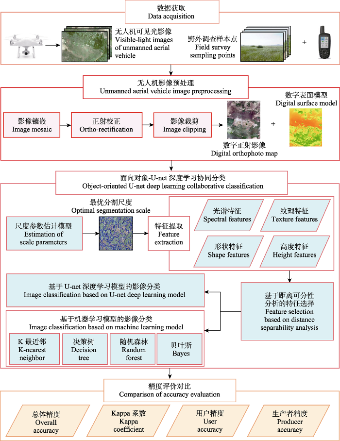
图2
基于面向对象-深度学习的滨海湿地植被分类流程图
Fig. 2
Flowchart of coastal wetland vegetation classification based on object-oriented deep learning
1.3.1 最优分割尺度选择
式中, f为异质性值, w为光谱信息权重, hcolor为光谱异质性值, hshape为形状异质性值, wcompact为紧凑度权重, hcompact为紧凑度值, hsmooth为光滑度值。
根据Drǎguţ等(2014)的研究, 对象的光谱/形状异质性权重为0.7/0.3、光滑度/紧凑度权重为0.5/0.5时, 识别不同湿地植被斑块的效果最佳, 因此本研究设置形状异质性和紧凑度权重分别为0.3和0.5。
利用尺度参数估计模型(estimation of scale parameters, ESP)定量确定最佳分割尺度。该模型通过多次迭代分割, 计算各分割尺度的局部方差(local variance, LV), 并通过局部方差变化率(rate of change of local variance, ROC-LV)反映局部方差的突变特征, 当ROC-LV出现峰值时所对应的分割尺度即为最优分割尺度备选值(Drǎguţ et al, 2010; 耿仁方等, 2019)。基于备选值集合(由最优精细分割尺度至最优粗略分割尺度多个备选分割尺度组成)对影像依次进行分割, 通过对比分割效果从而确定最优分割尺度。本研究通过多次预实验分析发现: 当分割尺度 < 15时, 分割时间显著增加; 当分割尺度 > 65时, 对象内异质性明显增大。由此, 本研究选择以15为初始分割尺度, 步长为1进行面向对象的多尺度分割, 迭代51次至分割尺度65为止。
1.3.2 影像特征提取与筛选
为充分挖掘不同植物物种影像特征的差异, 本研究在影像多尺度分割的基础上, 从光谱、纹理、形状和高度特征4个角度提取影像特征(费鲜芸等, 2021)。其中, 光谱特征包括各波段均值、标准差以及绿蓝差异指数(green-blue difference index, GBDI)、过绿指数(excess green index, ExG)、归一化绿蓝差异指数(normalized green-blue difference index, NGBDI)、归一化绿红差异指数(normalized green-red difference index, NGRDI)、可见光波段差异植被指数(visible-band difference vegetation index, VDVI)、过绿减过红指数(excess green minus excess red index, ExG-ExR)、差异增强植被指数(difference enhanced vegetation index, DEVI)等7个色彩指数, 共计13个特征; 纹理特征为基于灰度共生矩阵(gray level co-occurrence matrix, GLCM)的各对象均值、标准差、协同性、对比度、相异性、信息熵、二阶矩以及相关性等8个特征; 形状特征包括形状指数、紧凑性、密度、面积以及矩形度等5个特征; 高度特征包括地物高度的最大值、最小值、均值和标准差等4个特征。本研究由初始影像特征构成的30维特征空间具体信息如表1所示。
表1 基于无人机可见光影像的特征空间信息
Table 1
| 类型 Types | 特征指标 Feature factors | 公式/解释 Formula/Explanation | 筛选为最优特征组合 Be screened into the optimal feature combination | 参考文献 References | |
|---|---|---|---|---|---|
| 光谱特征 Spectral features | Mean_R | 红波段光谱亮度均值 Mean of red spectral brightness | 蔡林菲等, 2019 | ||
| Mean_G | 绿波段光谱亮度均值 Mean of green spectral brightness | √ | 蔡林菲等, 2019 | ||
| Mean_B | 蓝波段光谱亮度均值 Mean of blue spectral brightness | √ | 蔡林菲等, 2019 | ||
| SD_R | 红波段光谱亮度标准差 Standard deviation of red spectral brightness | √ | 路春燕等, 2021 | ||
| SD_G | 绿波段光谱亮度标准差 Standard deviation of green spectral brightness | √ | 路春燕等, 2021 | ||
| SD_B | 蓝波段光谱亮度标准差 Standard deviation of blue spectral brightness | √ | 路春燕等, 2021 | ||
| GBDI | 绿蓝差异指数 Green-blue difference index, GBDI = (G - B)/(R + G + B) | √ | 周涛等, 2021 | ||
| ExG | 过绿指数 Excess green index, ExG = (2G - R - B)/(G + R + B) | √ | 井然等, 2016 | ||
| NGBDI | 归一化绿蓝差异指数 Normalized green-blue difference index, NGBDI = (G - B)/(G + B) | √ | 汪小钦等, 2015 | ||
| NGRDI | 归一化绿红差异指数 Normalized green-red difference index, NGRDI = (G - R)/(G + R) | √ | Hunt et al, 2005 | ||
| VDVI | 可见光波段差异植被指数 Visible-band difference vegetation index, VDVI = (2G - B - R)/(2G + B + R) | 汪小钦等, 2015 | |||
| ExG-ExR | 过绿减过红指数 Excess green minus excess red index, ExG-ExR = (3G - 2.4R - B)/(R + G + B) | √ | 丁雷龙等, 2015 | ||
| DEVI | 差异增强植被指数 Difference enhanced vegetation index, DEVI = G/3G + R/3G + B/3G | 周涛等, 2021 | |||
| 纹理特征 Texture features | GLCM_Mean | 均值 Mean, | √ | 蔡林菲等, 2019 | |
| GLCM_SD | 标准差 Standard deviation, | √ | 蔡林菲等, 2019 | ||
| GLCM_Homogeneity | 协同性 Homogeneity, | 路春燕等, 2021 | |||
| GLCM_Contrast | 对比度 Contrast, | 路春燕等, 2021 | |||
| GLCM_Dissimilarity | 相异性 Dissimilarity, | √ | 路春燕等, 2021 | ||
| GLCM_Entropy | 信息熵 Entropy, | √ | 路春燕等, 2021 | ||
| GLCM_Secondary moment | 二阶矩 Secondary moment, | 路春燕等, 2021 | |||
| GLCM_Correlation | 相关性 Correlation, | √ | 路春燕等, 2021 | ||
| 形状特征 Shape features | Shape index | 形状指数, 反映整个斑块形状特点的指数 Shape index, an index reflecting the shape characteristics of the entire patch | √ | 耿仁方等, 2019 | |
| Compactness | 紧凑性, 反映斑块在空间分布上的紧密程度 Compactness, reflecting the tightness of patch distribution in space | √ | 耿仁方等, 2019 | ||
| Density | 密度, 反映单位面积上的斑块数量 Density, reflecting the number of patches per unit area | √ | 耿仁方等, 2019 | ||
| Area | 面积, 反映斑块所占空间的大小 Area, reflecting the size of the space occupied by the patch | √ | 耿仁方等, 2019 | ||
| Rectangularity fit | 矩形度, 反映斑块对其外接矩形的充满程度 Rectangularity fit, reflecting the degree of patch filling its surrounding rectangle | √ | 耿仁方等, 2019 | ||
| 特征类型 Feature types | 特征指标 Feature factors | 公式/解释 Formula/Explanation | 筛选为最优特征组合 Be screened into the optimal feature combination | 参考文献 References | |
| 高度特征 Height features | Max_Height | 高度最大值 Maximum height | 徐逸等, 2021 | ||
| Min_Height | 高度最小值 Minimum height | 徐逸等, 2021 | |||
| Mean_Height | 高度均值 Average height | 徐逸等, 2021 | |||
| SD_Height | 高度标准差 Standard deviation of height | 徐逸等, 2021 | |||
√ 表示该特征指标基于可分离性分析被筛选为最优特征组合。R、G、B分别表示在红、绿、蓝波段下影像像元的灰度值; 灰度共生矩阵描述的是θ方向上间距为d的一对像素灰度值分别为i和j出现的概率, 记为P(i, j, d, θ), L为影像灰度等级。
√ indicates that the feature factor is selected as the optimal feature combination based on separability analysis. R, G and B represent the gray values of pixels in red, green, and blue band, respectively. The gray level co-occurrence matrix describes the probability of occurrence of a pair of pixel gray values with a distance of d in the θ direction, i and j, respectively, denoted as P(i, j, d, θ), and L is the image gray level.
1.3.3 U-net深度学习模型
将面向对象分割后筛选出的最优特征与原始影像合成作为深度学习模型的输入层, 合成后的影像具有多图层, 既包含原始影像信息, 又包含面向对象的最优特征信息。综合考虑研究区不同滨海湿地植物物种的特征和复杂程度, 以256 × 256像素为基本单元、重复率为0.1对输入层影像数据进行裁剪, 得到672张图像; 同时, 为扩大U-net深度学习模型训练数据集, 将所有裁剪影像进行旋转、翻转等操作, 以此生成2,688张图像组成标记数据集。将该数据集分为训练数据集、验证数据集和测试数据集(比例为6 : 2 : 2), 用于U-net深度学习模型构建。
本研究基于Tensorflow深度学习框架, 运用python编程语言搭建U-net深度学习模型。U-net深度学习模型整体结构由两部分组成, 即收缩路径和扩张路径。收缩路径通过两次卷积(卷积核大小为3 × 3, 激活函数为ReLU)和一次最大池化(池化核大小为2 × 2)实现特征信息提取。扩张路径通过一次反卷积(卷积核大小为2 × 2)和两次卷积完成一次上采样过程, 用于精确定位(王振庆等, 2021), 从而提高运行效率, 减少参数计算(Wei et al, 2019)。U-net深度学习模型批大小batch_size设置为32, 学习率learning_rate为0.0001, 训练模型迭代轮数epochs为100, 优化器为Adam。
1.4 典型机器学习分类方法介绍与实现
1.4.1 K最近邻分类
1.4.2 决策树分类
1.4.3 随机森林分类
随机森林方法是一种基于分类和回归树的多决策分类树方法(Breiman, 2001)。随机森林的各决策树随机且有放回地从训练集抽取多个训练样本作为该树的训练集, 每棵决策树完成单独分类后, 经投票得到最后的输出结果。随机森林方法可以处理高维数据, 且具有避免过拟合和可以对特征重要性进行排序等优点。本研究使用R软件的randomForest包实现随机森林分类。
1.4.4 贝叶斯分类
贝叶斯分类(Bayes)是各种分类器中分类错误概率最小或者在预先给定代价的情况下平均风险最小的分类器, 其分类原理是通过某对象的先验概率, 利用贝叶斯公式计算出其后验概率, 即该对象属于某一类的概率, 选择具有最大后验概率的类作为该对象所属的类(沈妍琰等, 2020)。贝叶斯分类具有接受大量数据训练和查询时所具备的高速度, 支持增量式训练, 结果可解释性好。本研究具体采用R软件的bnlearn包实现贝叶斯分类。
1.5 分类准确性评估
基于野外实地采样点数据, 利用总体精度(overall accuracy, OA)、Kappa系数、用户精度(user accuracy, UA)和生产者精度(producer accuracy, PA) 对U-net深度学习模型和4种机器学习模型的分类精度进行评价。各评价参数具体计算公式如下(闻馨等, 2020):
式中, k为总类别数, N为总样本数, Nii为测试样本中i类被正确分类的样本数, Ni+为测试样本中i类的样本总数, N+i为实际分类中被分为i类的样本总数。
2 结果
2.1 最优分割尺度
图3
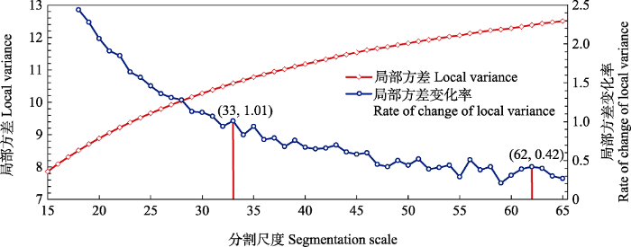
图3
不同分割尺度的局部方差及其变化率
Fig. 3
Local variance and its change rate for different segmentation scales
表2 最优精细至最优粗略分割尺度分割效果对比
Table 2
| 分割尺度 Segmentation scale | 分割效果 Segmentation effect | 分割尺度 Segmentation scale | 分割效果 Segmentation effect |
|---|---|---|---|
| 33 | 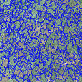 | 49 | 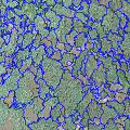 |
| 35 | 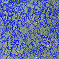 | 51 | 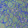 |
| 37 | 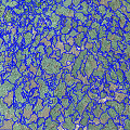 | 54 | 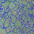 |
| 39 | 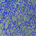 | 56 | 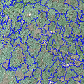 |
| 43 | 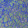 | 58 | 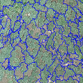 |
| 46 | 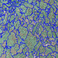 | 62 | 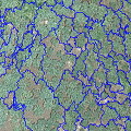 |
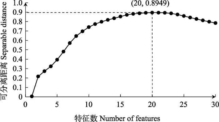
2.2 影像特征可分离性
图4
2.3 精度对比分析
在面向对象影像最优特征选取的基础上, 分别利用U-net深度学习方法和4种典型机器学习分类方法实现研究区滨海湿地植物物种的分类, 对比其分类结果(图5)及精度(表3)可知, U-net分类整体性最好, 混分、误分现象较其他分类的少, 能够有效避免“椒盐”现象。各分类结果的总体精度和Kappa系数按从大到小排序为: U-net > 贝叶斯 > 随机森林 > 决策树 > K最近邻。U-net深度学习方法的分类精度最高, 总体精度达95.67%, Kappa系数为0.91; 其中, 秋茄生产者精度和用户精度均最高, 为100%, 分析其原因, 可能是相比于研究区内其他湿地植物物种, 秋茄为木本植物, 树冠轮廓分明, 独立生长, 且群落内无混生现象, 具有较好的区分度。
图5
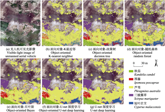
图5
基于不同方法的研究区湿地植被类型分类结果
Fig. 5
Classification results of wetland vegetation types in the study area based on different methods
表3 不同分类方法分类精度比较
Table 3
| 湿地植被类型 Wetland vegetation type | K最近邻 K-nearest neighbor | 决策树 Decision tree | 随机森林 Random forest | 贝叶斯 Bayes | U-net深度学习 U-net deep learning | |||||
|---|---|---|---|---|---|---|---|---|---|---|
| 生产者精度 Producer accuracy (%) | 用户精度 User accuracy (%) | 生产者精度 Producer accuracy (%) | 用户精度 User accuracy (%) | 生产者精度 Producer accuracy (%) | 用户精度 User accuracy (%) | 生产者精度 Producer accuracy (%) | 用户精度 User accuracy (%) | 生产者精度 Producer accuracy (%) | 用户精度 User accuracy (%) | |
| 短叶茳芏 Cyperus malaccensis | 60.00 | 92.31 | 80.95 | 100.00 | 90.48 | 100.00 | 71.43 | 100.00 | 75.00 | 93.75 |
| 三棱藨草 Scirpus mariqueter | 58.06 | 58.06 | 80.00 | 66.67 | 86.67 | 61.90 | 96.67 | 72.50 | 90.32 | 82.35 |
| 厚藤 Ipomoea pescaprae | 75.00 | 100.00 | 75.00 | 54.55 | 81.25 | 65.00 | 100.00 | 72.73 | 87.50 | 100.00 |
| 芦苇 Phragmites australis | 93.30 | 84.78 | 87.08 | 92.39 | 83.73 | 96.15 | 88.04 | 97.87 | 98.56 | 97.17 |
| 秋茄 Kandelia candel | 37.50 | 64.29 | 79.17 | 67.86 | 95.83 | 62.16 | 95.83 | 65.71 | 100.00 | 100.00 |
| 总体精度 Overall accuracy (%) | 82.00 | 84.67 | 85.33 | 89.00 | 95.67 | |||||
| Kappa系数 Kappa coefficient | 0.60 | 0.70 | 0.73 | 0.79 | 0.91 | |||||
对比各种分类方法, 不同植物物种的生产者精度和用户精度存在明显差异。其中, 芦苇的识别精度均较高, 其生产者精度和用户精度均在80%以上。在K最近邻、贝叶斯和U-net分类中, 厚藤的分类精度较高, 生产者精度和用户精度至少有一种可达100%。相比而言, 三棱藨草和短叶茳芏的识别精度较低。
图6
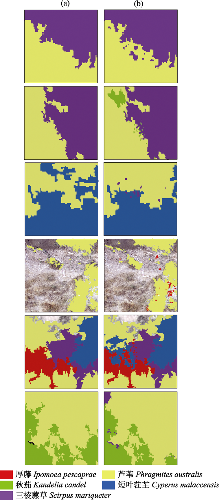
图6
面向对象-U-net深度学习(a)与U-net深度学习(b)方法分类结果局部细节对比。群落交界处各植物种类混生, 边界不清晰, 特征相似, 基于像素分类方法的结果“椒盐”现象明显, 易出现错分问题, 而面向对象分类方法可有效避免该问题, 能更为准确地区分不同植物种类。
Fig. 6
Local detail comparison of classification results between object-oriented U-net deep learning (a) and U-net deep learning (b). At the community boundary, plant species are often mixed with unclear outline and similar image characteristics. The results based on pixel classification method show obvious “pepper and salt” phenomenon, which is prone to misclassification. In contrast, object-oriented method could effectively avoid this problem and distinguish different plant species more accurately.
图7
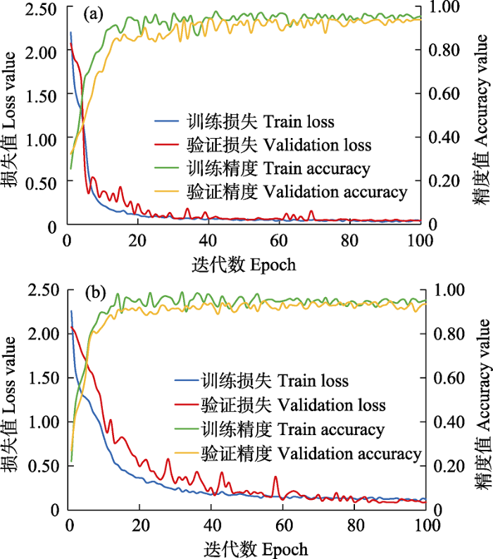
图7
面向对象-U-net深度学习(a)与U-net深度学习(b)分类方法的模型训练与验证损失值及精度对比
Fig. 7
Loss value and accuracy comparison of model training and validation between object-oriented U-net deep learning (a) and U-net deep learning (b)
3 讨论
滨海湿地植物物种精细化分类对滨海湿地生物多样性保护管理与监测具有重要意义。为此, 本研究选取闽江河口典型滨海湿地分布区为研究对象, 以无人机可见光遥感影像为基本数据源, 构建了一种面向对象-深度学习的滨海湿地植物物种识别与分类方法。该方法利用尺度参数估计模型定量确定影像最优分割尺度, 并基于距离可分性方法充分挖掘不同植物物种的影像特征差异, 集成面向对象与深度学习方法的优势, 分类结果整体性良好且精度高。基于该分类方法, 闽江河口典型滨海湿地植物物种分类结果总体精度达95.67%, 较以往研究具有一定的优势, 对不同滨海湿地植物物种的识别较为精准, 可为后期植物物种分类研究提供技术方法支持与参考借鉴。
相对于传统的基于像素分类的方法, 深度学习方法可有效提高植物物种分类的精度, 但因其基本处理单元为像素, 分类结果仍无法避免“椒盐”现象的产生, 使得后期处理的工作量增加。相比而言, 面向对象分类方法的基本处理单元为对象, 可有效避免该问题, 这与莫利江等(2012)和Li等(2015)的研究结果一致。尽管如此, 在面向对象分类过程中由于仅应用了低层次分类特征, 因此对于物种较多的复杂区域, 其分类精度难以进一步提高(代沁伶等, 2020)。由此, 本研究从整合优势的角度出发, 将面向对象与深度学习方法相结合, 避免了“椒盐”现象的产生与特征提取能力低等问题。此外, 为使分类结果和实际地物更为一致, 本研究定量确定了面向对象的最优分割尺度, 充分挖掘无人机可见光影像的光谱、纹理、形状和高度信息等30个特征, 相对于前人研究, 本研究构建的影像特征集具有数量大、维度高的特点。在此基础上, 为避免特征冗余、提高分类精度与模型分析效率, 进一步对最优特征组合进行定量筛选。同时, 为了更好地分析和探讨本研究分类方法的分类效果, 将U-net深度学习方法与4种常用的机器学习方法的分类结果进行了对比。该方法体系是滨海湿地植物物种多样性调查的有效补充手段, 对于滨海湿地植物物种精细制图具有参考价值。与闻馨等(2020)和周在明等(2021)的植物物种遥感分类相比, 本研究不仅增加了多维度特征进行物种识别, 更尝试利用U-net深度学习方法对滨海湿地植物物种进行高精度分类, 结果显示本研究分类方法具有分类结果整体性良好、精度较高的特点, 分类效果集成了面向对象与深度学习分类方法各自的优势, 也从侧面印证了本研究所构建的方法对于复杂植物物种的识别精度高、分类效果优良, 可为滨海湿地植物物种多样性调查及精细化管理提供技术参考。
本研究中, 高度特征未纳入最优特征组合, 主要原因为: 除红树林外, 研究区湿地植物物种均为草本植物, 高度差异较小; 而为防治互花米草, 研究区后期补种了人工种植的秋茄、芦苇、三棱藨草和短叶茳芏等本土植物幼苗, 幼苗植株较为矮小, 因此整体上研究区湿地植物物种高度差异不明显。此外, 结合分类结果及野外调查资料, U-net分类结果可更好地反映研究区植物物种的空间分布状况, 与不同滨海湿地植物物种的生态位分布相符合, 这与学者们对秋茄(卢昌义和林鹏, 1990)、厚藤(欧阳蒲月等, 2011)、三棱藨草(张利权和雍学葵, 1992)、芦苇和短叶茳芏(胡慧娟等, 2001)的研究结果一致。研究区植物群落整体呈由陆地到海洋的条带状空间分布, 群落交界处存在不同植物物种混合生长, 向海前缘处植物破碎化分布明显, 这与高会等(2017)对闽江口植物物种分布的描述一致。错分现象主要在群落交错区或植物稀疏区域, 例如: 芦苇的错分主要集中于植物群落交界地带以及向海前缘群落分布稀疏的地方。
尽管本研究取得了较好的分类效果, 但仍具有一定的局限性。因为遥感影像数据类型多样, 具有不同的优势与特点, 但本研究仅利用了无人机可见光影像, 提供的影像信息较为有限, 为增加可用信息的丰富度与提高研究的深入性, 在今后的实践中可尝试搭载其他传感器(如多光谱、高光谱、激光雷达等)或结合多种卫星遥感数据源, 综合其优势对植物物种进行识别与分类研究。此外, 本研究影像成像时间为夏季, 植物生长旺盛, 草本植物物种分类中易出现误分现象, 如本研究中三棱藨草和短叶茳芏的分类易误分, 但由于各草本植物的花果期不同, 其影像会有所差异, 应用于植物物种分类中可减少误分现象, 因此未来可尝试增加多时相影像做进一步探索。
致谢
感谢闽江河口湿地国家级自然保护区工作人员对本研究野外调查工作的帮助!
参考文献
Economic Valuation of Wetlands: A Guide for Policy Makers and Planners
Random forests
DOI:10.1023/A:1010933404324 URL [本文引用: 1]
Classification and regression trees
Tree species identification using XGBoost based on GF-2 images
基于XGBoost的高分二号影像树种识别
A convolution neural network model with adaptive learning rate and its application—A case study of remote sensing classification of coastal wetland
一种自适应学习率的卷积神经网络模型及应用——以滨海湿地遥感分类为例
Feature selection by combining subspace learning with sparse representation
Nearest neighbor pattern classification
DOI:10.1109/TIT.1967.1053964 URL [本文引用: 1]
Regional multiscale Markov random field for remote sensing image classification
区域多尺度马尔可夫随机场的遥感影像分类
Vegetation extraction method based on color indices from UAV images
基于无人机图像颜色指数的植被识别
Automated parameterisation for multi-scale image segmentation on multiple layers
DOI:10.1016/j.isprsjprs.2013.11.018 URL [本文引用: 1]
ESP: A tool to estimate scale parameter for multiresolution image segmentation of remotely sensed data
DOI:10.1080/13658810903174803 URL [本文引用: 1]
Classification of Linhong River estuary wetland based on GF-1 satellite image
基于GF-1卫星影像的临洪河口湿地遥感分类
Silica distribution characteristics in plant-soil systems of typical vegetation communities and ecotones in Min River estuary wetland
闽江河口典型植被群落带及交错带植物-土壤体系中硅素的分布特征
Object-based karst wetland vegetation classification method using unmanned aerial vehicle images and random forest algorithm
基于无人机影像和面向对象随机森林算法的岩溶湿地植被识别方法研究
DOI:10.12082/dqxxkx.2019.180631
[本文引用: 6]

目前对岩溶湿地的重视程度远低于其他湿地类型,缺乏利用遥感技术进行岩溶湿地植被高精度识别的研究,但岩溶湿地同其他湿地类型一样,湿地面积退化严重,亟待需要解决。因此,本文选取受人类活动影响较大、湿地退化较为严重的广西桂林会仙喀斯特国家湿地公园的部分核心区域作为研究区,以DJI大疆御Mavic Pro无人机航摄影像为数据源,利用泛化能力强、分类精度高的面向对象随机森林算法实现了会仙岩溶湿地植被的高精度分类,探究无人机可见光影像和面向对象随机森林算法在岩溶湿地植被识别中的适用性,为无人机遥感技术应用于岩溶湿地的研究和保护提供技术参考。首先,在eCognition Developer9.0中利用多尺度迭代分割算法对影像图层进行分割;然后,基于以往在进行面向对象分类研究的经验来指导我们进行特征选择,充分考虑了影像的光谱和纹理特征、植被指数、无人机遥感数据派生的研究区数字地表模型(DSM)和几何特征;最后,在RStudio中实现了随机森林算法参数的调优、模型的构建以及分类。结果显示,面向对象随机森林算法对会仙湿地植被具有较高的识别能力,在95%置信区间内总体精度为86.75%,Kappa系数为0.83。在单一典型岩溶湿地植被识别精度中,狗牙根-白茅-水龙植被群丛的用户精度在90%以上,生产者精度高于80%,竹子-马甲子-桂花生产者精度高于80%,但是用户精度较低,仅为70.59%。
Remote sensing has become an indispensable technology for biodiversity research protection and change monitoring
DOI:10.17520/biods.2018234 [本文引用: 1]
遥感已经成为生物多样性研究保护与变化监测不可或缺的技术手段
DOI:10.17520/biods.2018234 [本文引用: 1]
Plant ecology of the outer coast of the Minjiang River estuary in Fujian
福建闽江口外海岸植物生态
Combining textures and spatial features to extract tea plantations based on object-oriented method by using multispectral image
结合纹理和空间特征的多光谱影像面向对象茶园提取
Evaluation of digital photography from model aircraft for remote sensing of crop biomass and nitrogen status
DOI:10.1007/s11119-005-2324-5 URL [本文引用: 1]
Study on biomass dynamics of Phragmites communis community in Panjin wetland
盘锦湿地芦苇群落生物量动态特征研究
Object-oriented aquatic vegetation extracting approach based on visible vegetation indices
基于可见光植被指数的面向对象湿地水生植被提取方法
DOI:10.13287/j.1001-9332.201605.002
[本文引用: 1]
利用ESP分割工具确定最佳分割尺度,通过多尺度分割算法创建最优分割影像,基于微型无人机影像数据生成可见光植被指数,从一系列可见光植被指数中选取一组最优植被指数,建立决策树规则,利用隶属度函数对研究区自动分类,生成水生植被分布图.结果表明: 监督分类法的总体精度为53.7%,面向对象分类法总体精度为91.7%,与基于像元的监督分类法相比,面向对象分类法显著改善了影像分类结果,并大大提高了水生植被提取精度,监督分类法的Kappa系数为0.4,而面向对象分类法的Kappa系数为0.9.这表明利用微型无人机数据生成的可见光植被指数结合面向对象分类方法提取水生植被在该研究区是可行的,并能够应用到其他类似区域.
Classification and identification of plant species based on multi-source remote sensing data: Research progress and prospect
DOI:10.17520/biods.2019197
[本文引用: 1]
Species classification and identification is the basis of biodiversity monitoring, and is critical to deal with almost all ecological questions. In this paper, we aim to understand the current status and existing problems in plant species classification and identification using multi-source remote sensing data. We summarized the studies in this field since the year 2000, and found that most of these studies focus on temperate or boreal forests in Europe and North America, or African savanna. Airborne hyperspectral data is the most widely used remote sensing data source, and the LiDAR, as a supplementary data, significantly improves the classification accuracy through the information of single tree segmentation and three-dimensional vertical structure. Support vector machine and random forest are the most widely used non-parametric classification algorithms with an average classification accuracy of 80%. With the development of computer technology and machine learning, artificial neural network has developed rapidly in species identification. Based on the literature-based analysis, we propose that the current research in this field is still facing some challenges, including the complexity of classification objects, the effective integration of multi-source remote sensing data, the integration of plant phenology and texture characteristics, and the improvement in plant classification algorithm. The accuracy of plant classification and identification could be greatly improved by using the high-frequency data collection over time, the integration of hyperspectral and LiDAR data, the use of specific spectral information such as short-wave infrared imagery, and the development of novel deep learning techniques.
基于多源遥感数据的植物物种分类与识别: 研究进展与展望
DOI:10.17520/biods.2019197
[本文引用: 1]
物种分类与识别是生物多样性监测的基础, 明确物种的类别及其分布是解决几乎所有生态学问题的前提。为深入了解基于多源遥感数据的植物物种分类与识别相关研究的发展现状和存在的问题, 本文对2000年以来该领域的研究进行了总结分析, 发现: 当前大多数研究集中在欧洲和北美地区的温带或北方森林以及南非的热带稀树草原; 使用最多的遥感数据是机载高光谱数据, 而激光雷达作为补充数据, 通过单木分割及提供单木的三维垂直结构信息, 显著提高了分类精度; 支持向量机和随机森林作为应用最广的非参数分类算法, 平均分类精度达80%; 随着计算机技术及机器学习领域的不断成熟, 人工神经网络在物种识别领域得以迅速发展。基于此, 本文对目前基于遥感数据的植物物种分类与识别中在分类对象复杂性、多源遥感数据整合、植物物候与纹理特征整合和分类算法技术等方面面临的挑战进行了总结, 并建议通过整合多时相监测数据、高光谱和激光雷达数据、短波红外等特定波谱信息、采用深度学习等方法来提高分类精度。
Object-based crop classification with landsat-MODIS enhanced time-series data
DOI:10.3390/rs71215820 URL [本文引用: 1]
Waterfowl resources and protection in Minjiang River estuary wetland
闽江河口湿地水禽资源及其保护
Comparison of mangrove remote sensing classification based on multi-type UAV data
DOI:10.13284/j.cnki.rddl.003150
[本文引用: 1]
<p>Mangroves have important ecological functions. Where damage to mangroves is severe, remote sensing can be used to monitor the situation and provide information to support mangrove protection and resource management. Remote sensing using Unmanned Aerial Vehicles (UAVs) is flexible, low cost, and has higher spatial and temporal resolution than does satellite data. It has been successfully applied to a variety of research questions, including habitat classification. To popularize the application of UAVs in mangrove remote sensing, and summarize the data acquisition problems faced in this approach, it is necessary to compare and analyze the classification results of mangrove data from multi-type UAV surveys. In this study, fixed-wing UAVs, consumer rotorcraft UAVs, and professional rotorcraft UAVs are used to acquire images of Qi’ao Island Mangrove Reserve in Zhuhai, Guangdong Province. Using the object-oriented classification method, K-nearest neighbor, and random forest classifier, we classified mangrove species in the study area and compared the results from different UAVs. The classification accuracy of fixed-wing UAVs, consumer rotorcraft UAVs, and professional rotorcraft UAVs using the K-nearest neighbor method was 73.8%, 72.8%, and 79.7%, respectively, and that of the random forest method was 81.1%, 84.8%, and 89.3%, respectively. All three UAV types provided data that was suitable for mangrove classification. Random forest classification results were better than those of K-nearest neighbor classification; so, for UAV mangrove remote sensing data, priority should be given to the random forest method. Data acquisition efficiency was estimated by calculating the ratio of imaging area to acquisition time. Fixed-wing UAV, consumer rotorcraft UAV, and professional rotorcraft UAV collected data at 0.036, 0.013, and 0.003 km2/min, respectively. The fixed-wing UAV collected data much more rapidly than did the other UAVs, making it suitable for large-scale mangrove data acquisition. The professional rotorcraft UAV had the lowest data acquisition efficiency, but is low cost and easy to learn and use, making it suitable for the acquisition of small-scale data. Different UAVs had different sensors; the classification accuracy of the fixed-wing and consumer rotorcraft UAV data were similar, while that of the professional rotorcraft UAV was higher. The professional rotorcraft UAV was the most suitable for acquiring multi-source data as it has slightly heavier sensors, which include an imaging spectrometer and LiDAR. In the application of UAVs to mangrove remote sensing, attention should be paid to flight safety and data acquisition quality, and a reasonable data acquisition plan should be made depending on the research content and area under study. In this paper, we suggest approaches for the effective application of UAVs to mangrove remote sensing research.</p>
基于多类型无人机数据的红树林遥感分类对比
Progress of Chinese coastal wetland based on remote sensing
中国滨海湿地遥感研究进展
Classification of Yancheng coastal wetland vegetation based on vegetation phenological characteristics derived from Sentinel-2 time-series
DOI:10.11821/dlxb202107008
[本文引用: 1]
Coastal wetlands are special land-sea transitional ecosystems with important functions. It is of great significance to obtain the spatiotemporal distribution data of coastal wetland vegetation accurately. Previous wetland mapping studies focusing mainly on high spatial and spectral resolution images often have difficulties such as high data acquisition costs and limited coverage, so these methods are only suitable for small regions. Sentinel-2A/B satellite images with high spatial and temporal resolution and free sharing, make it possible for us to dynamically monitor large-area coastal wetlands. Based on Sentinel-2 images in 2018, this study proposed the pixel-level SAVI time series and double logistic vegetation phenological feature fitting reconstruction model, used a random forest algorithm to classify Yancheng coastal wetland vegetation in Jiangsu, East China, and then discussed the applicability of vegetation phenological characteristics (VPC) classification method. The results show that the overall accuracy of mapping based on VPC was 87.61%, which was 19.57% higher than that of the conventional single image classification, and the results were consistent with the actual distribution of wetlands. The vegetation discriminant phenological parameters can provide the basis for differentiating various types of vegetation, which can be applied to coastal wetland classification in the case of missing or insufficient image data. The phenological parameters have improved the method based on VPC, which can be applied to the rapid and accurate extraction of coastal vegetation and also provides new ideas to solve the problem of insufficient data in coastal wetland classification research. The method based on VPC in the pixel-level time series can achieve the accurate classification of the mixed zone of vegetation communities and the effective differentiation of "the same spectrum with different objects", which is applicable to the coastal wetland classification in large regions and improves the mapping accuracy of coastal wetland vegetation effectively.
基于Sentinel-2遥感时间序列植被物候特征的盐城滨海湿地植被分类
DOI:10.11821/dlxb202107008
[本文引用: 1]
滨海湿地是具有重要功能的特殊海陆过渡带生态系统,精准获取滨海湿地植被时空分布信息具有重要意义。传统的湿地遥感观测研究集中于高空间、高光谱分辨率影像分类,往往受限于数据成本和覆盖范围,仅适用于小区域湿地监测。Sentinel-2A/B卫星影像时空分辨率高且免费共享,为大区域滨海湿地动态监测提供了可能。本文采用2018年Sentinel-2影像,提出像元级SAVI时间序列及双Logistic植被物候特征拟合重构模型,采用随机森林算法进行盐城滨海湿地植被分类,探讨Sentinel-2遥感时间序列植被物候特征分类方法的适用性。结果显示,分类总体精度达87.61%,Kappa系数为0.8358,分类结果与湿地实况相吻合,比常规单一时相分类精度总体提高19.57%。植被判别物候特征参数可为影像数据缺失或不足的滨海湿地分类提供不同植被的判别依据。研究表明,基于像元级时间序列植被物候特征的分类方法能实现植被群落混生带的精准分类以及对“异物同谱”植被的有效区分,对大区域滨海湿地植被分类具有很好的适用性,有效提高了滨海湿地植被分类精度。
Remote sensing analysis of wetland dynamics based on object-oriented and deep learning in the low-elevation coastal zone of Southeast Fujian
基于面向对象-深度学习的闽东南低海拔海岸带地区湿地动态遥感分析
Afforesting techniques of Kandelia candel mangrove and their ecological principle
秋茄红树林的造林技术及其生态学原理
Dynamic analysis of mangrove forests based on an optimal segmentation scale model and multi-seasonal images in Quanzhou Bay, China
DOI:10.3390/rs10122020
URL
[本文引用: 1]
Mangrove forests are important coastal ecosystems and are crucial for the equilibrium of the global carbon cycle. Monitoring and mapping of mangrove forests are essential for framing knowledge-based conservation policies and funding decisions by governments and managers. The purpose of this study was to monitor mangrove forest dynamics in the Quanzhou Bay Estuary Wetland Nature Reserve. To achieve this goal, we compared and analyzed the spectral discrimination among mangrove forests, mudflats and Spartina using multi-seasonal Landsat images from 1990, 1997, 2005, 2010, and 2017. We identified the spatio-temporal distribution of mangrove forests by combining an optimal segmentation scale model based on object-oriented classification, decision tree and visual interpretation. In addition, mangrove forest dynamics were determined by combining the annual land change area, centroid migration and overlay analysis. The results showed that there were advantages in the approaches used in this study for monitoring mangrove forests. From 1990 to 2017, the extent of mangrove forests increased by 2.48 km2, which was mostly converted from mudflats and Spartina. Environmental threats including climate change and sea-level rise, aquaculture development and Spartina invasion, pose potential and direct threats to the existence and expansion of mangrove forests. However, the implementation of reforestation projects and Spartina control plays a substantial role in the expansion of mangrove forests. It has been demonstrated that conservation activities can be beneficial for the restoration and succession of mangrove forests. This study provides an example of how the application of an optimal segmentation scale model and multi-seasonal images to mangrove forest monitoring can facilitate government policies that ensure the effective protection of mangrove forests.
Sustainability associated coastal eco- environmental problems and coastal science development in China
中国海岸带可持续发展中的生态环境问题与海岸科学发展
Object-oriented classification for satellite remote sensing of wetlands: A case study in southern Hangzhou Bay area
面向对象的湿地景观遥感分类——以杭州湾南岸地区为例
Object-oriented classification of high-resolution image combining super-pixel segmentation
融入超像素分割的高分辨率影像面向对象分类
Research on residential buildings recognition by decision tree classification model
决策树分类模型的住宅建筑物图斑识别
Biological and ecophysiological characteristics of a beach plant Ipomoea pescaprae
海滩植物厚藤(Ipomoea pescaprae)的生物学及生理生态特性
Dynamic monitoring analysis of expansion of Spartina alterniflora in Fujian
福建沿海水域互花米草蔓延的动态监测分析
Review and evaluation of deep learning architectures for efficient land cover mapping with UAS hyper-spatial imagery: A case study over a wetland
DOI:10.3390/rs12060959
URL
[本文引用: 1]
Deep learning has already been proved as a powerful state-of-the-art technique for many image understanding tasks in computer vision and other applications including remote sensing (RS) image analysis. Unmanned aircraft systems (UASs) offer a viable and economical alternative to a conventional sensor and platform for acquiring high spatial and high temporal resolution data with high operational flexibility. Coastal wetlands are among some of the most challenging and complex ecosystems for land cover prediction and mapping tasks because land cover targets often show high intra-class and low inter-class variances. In recent years, several deep convolutional neural network (CNN) architectures have been proposed for pixel-wise image labeling, commonly called semantic image segmentation. In this paper, some of the more recent deep CNN architectures proposed for semantic image segmentation are reviewed, and each model’s training efficiency and classification performance are evaluated by training it on a limited labeled image set. Training samples are provided using the hyper-spatial resolution UAS imagery over a wetland area and the required ground truth images are prepared by manual image labeling. Experimental results demonstrate that deep CNNs have a great potential for accurate land cover prediction task using UAS hyper-spatial resolution images. Some simple deep learning architectures perform comparable or even better than complex and very deep architectures with remarkably fewer training epochs. This performance is especially valuable when limited training samples are available, which is a common case in most RS applications.
-Net:Convolutional networks for biomedical image segmentation
In: Medical Image Computing and Computer-Assisted Intervention—MICCAI 2015 (eds Navab N, Hornegger J, Wells W, Frangi A), pp. 234-241. Springer, Cham.
Identification and validation of sea-wave echoes collected by a Doppler weather radar based on a Bayes classifier
基于贝叶斯分类器的多普勒天气雷达海浪回波识别和效果检验
Parameters of multi-segmentation based on segmentation evaluation function
基于分割评价函数的多尺度分割参数的选择
Landscape changes of the Yancheng wetland in the past 20 years: Evidence from random forest
基于随机森林的盐城湿地近20年景观格局变化
Improving the accuracy of forest identification in mountainous areas from multi-source remote sensing data—The Sunan County section of Qilian Mountains National Park as an example
基于多源遥感数据提高山地森林识别精度——以祁连山国家公园肃南县段为例
Development status and literature analysis of China’s earth observation remote sensing satellites
中国地球观测遥感卫星发展现状及文献分析
Methane dynamics of a brackish-water tidal Phragmites australis marsh in the Minjiang River estuary
闽江口半咸水芦苇潮汐沼泽湿地甲烷动态
A small-patched convolutional neural network for mangrove mapping at species level using high-resolution remote-sensing image
DOI:10.1080/19475683.2018.1564791 URL [本文引用: 1]
Researches on mangrove forest monitoring methods based on multi-source remote sensing
DOI:10.17520/biods.2018067
[本文引用: 1]
Mangrove forests are ecological communities growing in the intertidal zone of tropical and subtropical coastlines. Due to their high productivity, mangrove forests are essential to persistence of biodiversity along coastlines and have high carbon sequestration ability. In this article we review aspects of monitoring mangrove forests using recent multi-source remote sensing data. First, we reviewed studies on monitoring mangrove dynamics. By integrating object-based and pixel-based classification, high spatial resolution images were used to classify different mangrove species. Landsat images were then used to monitor the dynamics of mangrove forests and analyze factors driving them. Second, we reviewed studies measuring structural parameters of mangroves. Specifically, unmanned aerial vehicle multispectral data and ground-based Light Detection and Ranging (LiDAR) data were used to compute leaf area index of mangrove forests. Finally, we reviewed studies examining physiology and biochemistry parameters. These studies explored adaption of chlorophyll content in mangrove forests under different submergence conditions, whether the invasive species Spartina alterniflora affects the light use efficiency and changed the response of photochemical reflectance index (PRI) to LUE. Our review provides a useful reference for selecting appropriate analytical methods when extracting information of mangroves from remotely sensed data. We emphasize the effectiveness of remote sensing in studying mangrove spatiotemporal patterns, extracting structural parameters, monitoring biochemical parameters, thus aiding efforts to conserve mangrove ecosystems.
基于多源遥感的红树林监测
DOI:10.17520/biods.2018067
[本文引用: 1]
红树林是生长在热带以及亚热带海岸潮间带上的生态群落, 其生产力高, 固碳能力强, 对保持海岸带生物多样性具有十分重要的价值。本文介绍了利用多源遥感数据监测红树林的一些主要研究内容, 分为3个方面: (1)在时空模式研究方面, 利用高空间分辨率影像像素和对象结合的方法对红树林树种进行分类以及利用Landsat影像对红树林进行动态变化监测并分析其驱动因素; (2)在结构参数研究方面, 利用无人机多光谱数据及地面激光雷达数据对红树林叶面积指数进行反演; (3)在生理生化参数研究方面, 探讨了红树林叶绿素含量对淹没状况的响应、互花米草(Spartina alterniflora)入侵是否影响红树林光能利用率, 以及光化学反射指数(photochemical reflectance index, PRI)与光能利用率(light use efficiency, LUE)的关系。上述系列研究为提取红树林相关信息要素时如何选择合适的分析方法提供了有力的参考, 强调了遥感在研究红树林时空模式, 提取结构参数和生物生化参数监测的有效性, 从而更好地促进红树林生态系统的生物多样性保育工作。
Extraction of vegetation information from visible unmanned aerial vehicle images
基于可见光波段无人机遥感的植被信息提取
House building extraction from high-resolution remote sensing images based on IEU-Net
IEU-Net高分辨率遥感影像房屋建筑物提取
Multi-temporal SAR data large-scale crop mapping based on U-net model
DOI:10.3390/rs11010068
URL
[本文引用: 1]
Due to the unique advantages of microwave detection, such as its low restriction from the atmosphere and its capability to obtain structural information about ground targets, synthetic aperture radar (SAR) is increasingly used in agricultural observations. However, while SAR data has shown great potential for large-scale crop mapping, there have been few studies on the use of SAR images for large-scale multispecies crop classification at present. In this paper, a large-scale crop mapping method using multi-temporal dual-polarization SAR data was proposed. To reduce multi-temporal SAR data redundancy, a multi-temporal images optimization method based on analysis of variance (ANOVA) and Jeffries–Matusita (J–M) distance was applied to the time series of images after preprocessing to select the optimal images. Facing the challenges from smallholder farming modes, which caused the complex crop planting patterns in the study area, U-Net, an improved fully convolutional network (FCN), was used to predict the different crop types. In addition, the batch normalization (BN) algorithm was introduced to the U-Net model to solve the problem of a large number of crops and unbalanced sample numbers, which had greatly improved the efficiency of network training. Finally, we conducted experiments using multi-temporal Sentinel-1 data from Fuyu City, Jilin Province, China in 2017, and we obtained crop mapping results with an overall accuracy of 85% as well as a Kappa coefficient of 0.82. Compared with the traditional machine learning methods (e.g., random forest (RF) and support vector machine (SVM)), the proposed method can still achieve better classification performance under the condition of a complex crop planting structure.
Identification of mangrove canopy species based on visible unmanned aerial vehicle images
基于无人机可见光影像的红树林冠层群落识别
UAV-based hyperspectral images and monitoring of canopy tree diversity
DOI:10.17520/biods.2021013
[本文引用: 1]
Background & Aims: The species diversity of canopy trees is important for the function and service of natural forest ecosystems. To be able to formulate reasonable biodiversity conservation strategies, it is important to understand patterns of forest canopy diversity through time. However, the development of high-precision forest canopy diversity monitoring at a regional scale is slow due to a limitation in diversity information collection methods. A lot of biodiversity patterns may substantially change due to climate change and human disturbance. However, updating these changes in biodiversity cannot be done in a timely manner. In recent years, the development of canopy hyperspectral image collection based on unmanned aerial vehicle (UAV) and analysis technology has provided an opportunity for the development of new tools for canopy diversity monitoring.Progresses: Here, we propose using the hyperspectral image of forest canopy for biodiversity monitoring and conservation, development of UAV aerial photography and spatial positioning technology, and the development of hyperspectral image processing technology with deep learning. We use the existing literature to discuss the research status, feasibility, advantages, and disadvantages of using UAV hyperspectral imaging for monitoring of species diversity of forest canopy trees. We believe that canopy hyperspectral images provide indispensable and abundant information for forest biodiversity monitoring. The combination of UAVs and hyperspectral cameras makes it possible to automate the collection of canopy diversity information with both high frequency (e.g., weekly) and high precision (e.g., decimeter- or centimeter-level) at the regional scale. At the same time, the leap in image processing technology made possible through deep learning enables the extraction of individual and species information from canopy hyperspectral images with extremely high precision.Prospects: Hyperspectral images have rich spectral and spatial information, which greatly improves the identification accuracy of plant species. The combination of UAVs and hyperspectral cameras greatly reduces the difficulty and cost for acquisition of this data. Applying deep learning methods to hyperspectral image processing can effectively collect species diversity information contained in hyperspectral images, and accelerate the research on forest canopy diversity monitoring on a large-scale. However, due to an insufficient sample size of hyperspectral data for species and a limitation in common deep learning models not being fully optimized for hyperspectral images remains a challenge. Future challenges for research include: how to build the hyperspectral species database, how to combine the characteristics of hyperspectral data, and how to optimize the automatic species recognition algorithm.
无人机高光谱影像与冠层树种多样性监测
DOI:10.17520/biods.2021013
[本文引用: 1]
冠层树种多样性是自然森林生态系统功能和服务的重要基础。及时掌握冠层多样性的现状及变化趋势, 是探讨诸多重要生态学问题的前提, 更是制定合理生物多样性保护策略的基础。但受制于传统的多样性信息采集方法, 区域尺度的高精度冠层多样性监测发展较为缓慢; 许多在气候变化和人类干扰下的生物多样性分布信息得不到及时更新。近年来基于无人机的冠层高光谱影像收集与分析技术的发展, 使得冠层多样性监测迎来了新的发展契机。本文从森林冠层高光谱影像出发, 介绍了与多样性监测相关的无人机航拍和基于深度学习的图像处理技术, 并结合已有文献, 探讨了无人机高光谱应用于森林冠层树种多样性监测的研究现状、可行性、优势及缺陷等。我们认为冠层高光谱影像为多样性监测提供了不可或缺且丰富的原始信息; 而无人机与高光谱相机的结合, 使得区域化高频率(如每周)、高精度(如分米乃至厘米级)的冠层多样性信息自动化收集成为可能。然而高光谱影像数据量大、数据维度高与数据结构非线性的特点为影像处理带来了挑战, 而深度学习技术的飞跃, 使得从冠层高光谱影像中提取个体及物种信息达到了极高精度。恰当地使用这些技术将大大提升冠层树种多样性的自动化监测水平, 由此也将帮助我们在当前剧变环境下及时掌握森林冠层多样性的现状与变化, 为生物多样性研究与保护提供可靠的数据支撑。
Mangrove species classification with UAV-based remote sensing data and XGBoost
无人机遥感与XGBoost的红树林物种分类
Landscape naturalness assessment of the Minjiang River Estuary Wetland Nature Reserve and surrounding areas
闽江河口湿地自然保护区及其周边区域景观自然性评价
Spatiotemporal dynamic remote sensing monitoring of typical wetland vegetation in the current Huanghe River Estuary Reserve
现行黄河口保护区典型湿地植被时空动态遥感监测
Studies on phenology and spatial distribution pattern of Scirpus mariqueter population
海三棱藨草种群的物候与分布格局研究
Learning k for kNN classification
Green vegetation extraction based on visible light image of UAV
基于无人机可见光影像的绿色植被提取
Identification of the mangrove species using UAV hyperspectral images: A case study of Zhangjiangkou Mangrove National Nature Reserve
基于无人机高光谱特征的红树林种群识别研究——以漳江口红树林国家级自然保护区为例
