生物多样性 ›› 2016, Vol. 24 ›› Issue (6): 701-708.  DOI: 10.17520/biods.2015283

• 生物编目 • 上一篇    下一篇

生物多样性野外调查地理信息管理、路线精细设计和精确导航方法

陈彬*()   

  1. 上海辰山植物园, 上海 201602
  • 出版日期:2016-06-20 发布日期:2016-06-20
  • 通讯作者: 陈彬
  • 基金资助:
    辰山专项——“在线活植物志”的方法研究、平台建设及其在华东地区的应用实践(G162418)

Geographic data management, refined route design and precise navigation in biodiversity field surveys

Bin Chen*()   

  1. Shanghai Chenshan Botanical Garden, Shanghai 201602
  • Online:2016-06-20 Published:2016-06-20
  • Contact: Chen Bin

摘要:

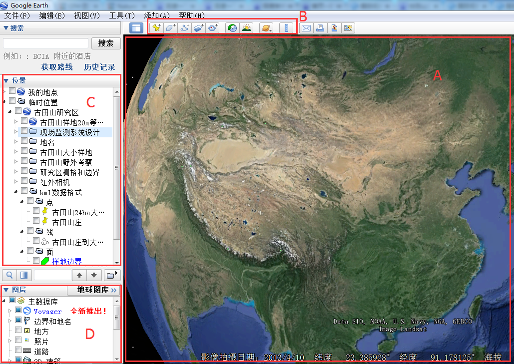
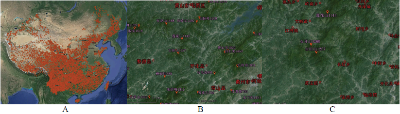
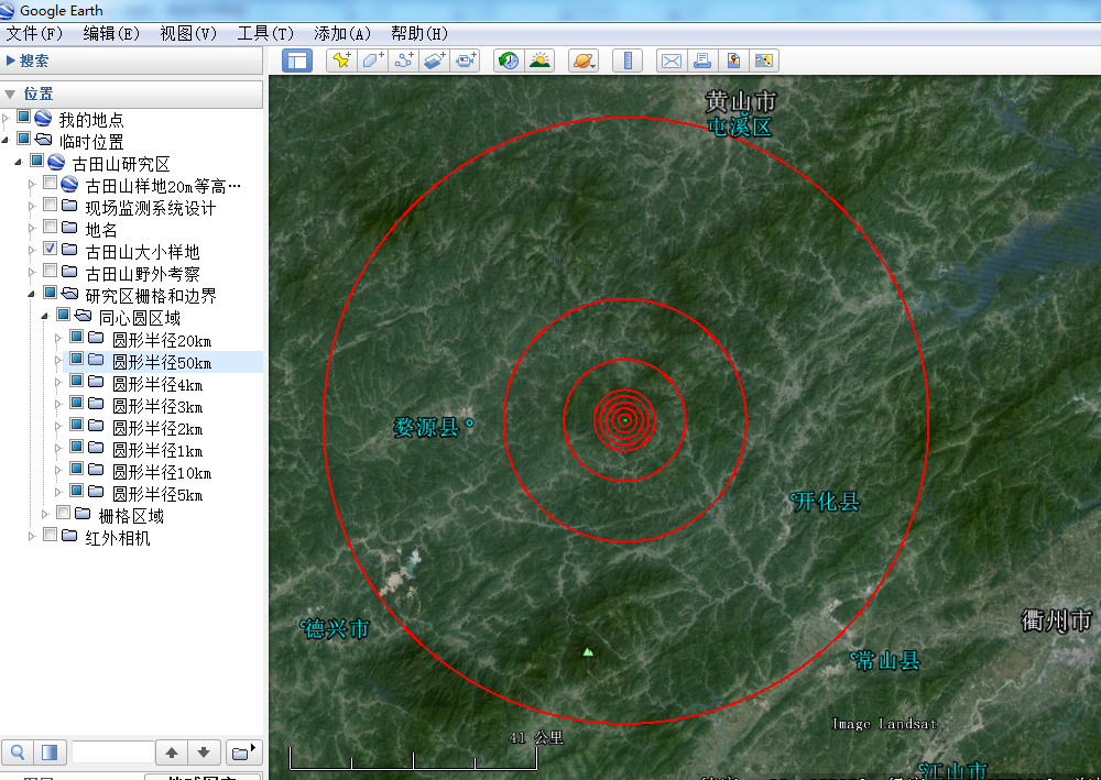
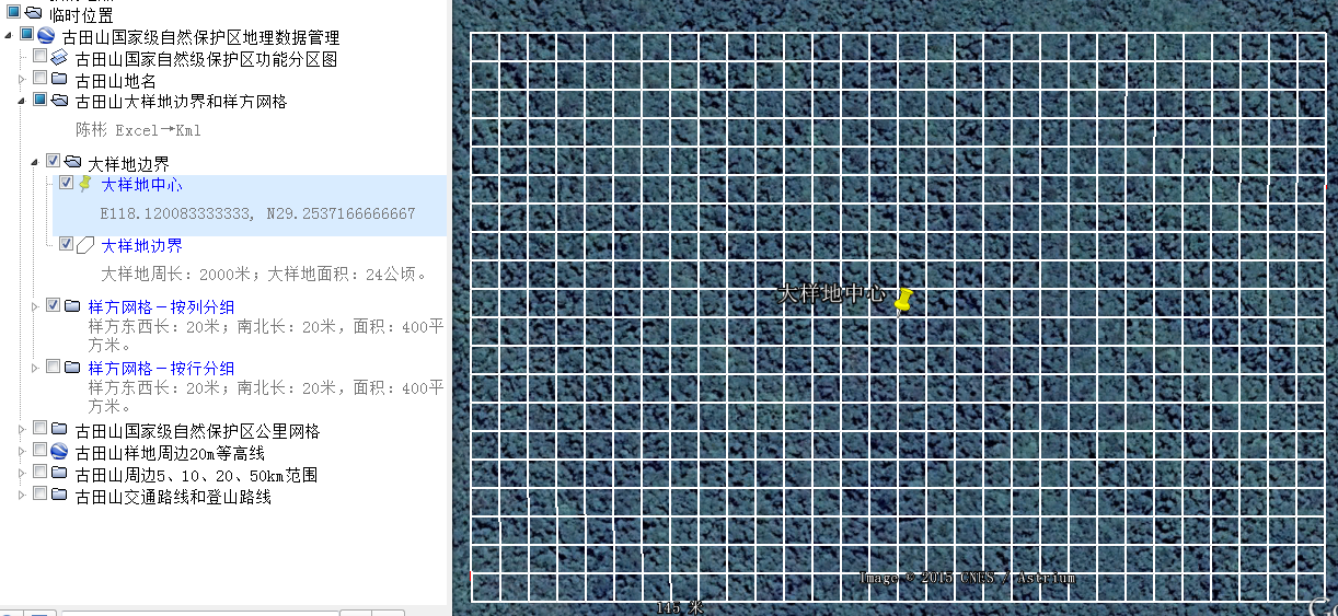
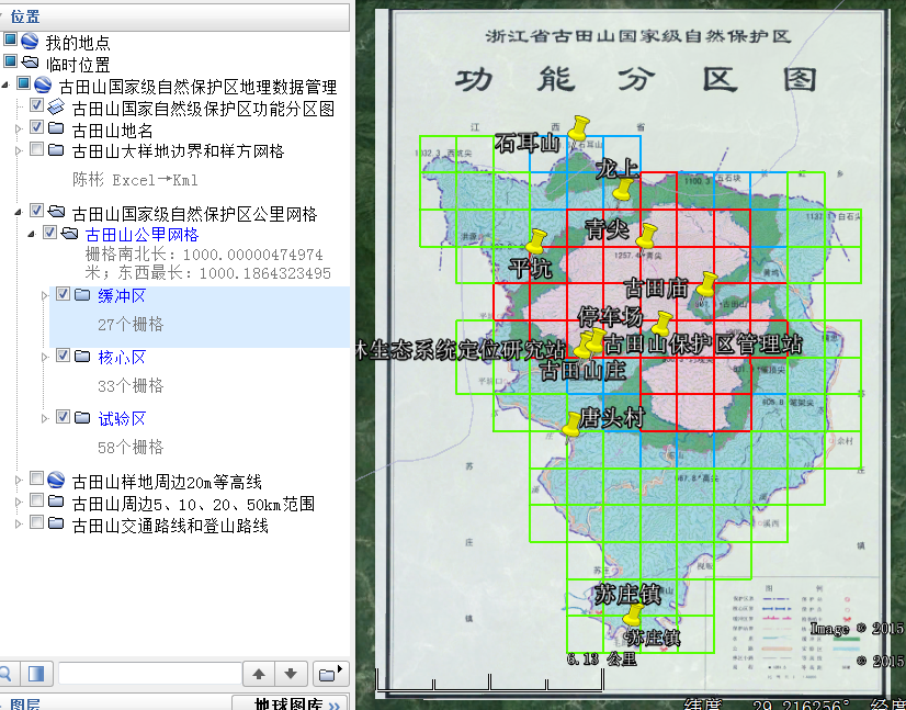
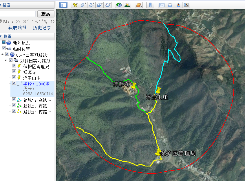
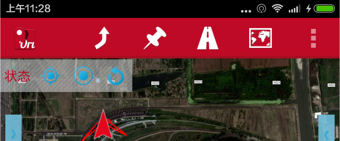
野外调查是生物多样性研究和保护的基础工作。在野外调查中, 自然地理环境十分复杂, 对相关地理信息的掌握程度、调查路线的设计质量和导航的准确性, 直接影响调查工作的成效, 甚至调查人员的人身安全。使用谷歌地球软件及相关数据转换工具, 能获取海量遥感影像和地形数据, 能将各种地理信息转换、编辑、叠加到三维地球模型上形成地理信息库, 进而精细设计野外考察路线、调查点和调查样方, 并以kml或kmz文件格式保存和分发设计结果。使用Android智能终端设备安装OruxMaps软件, 可以将多种网络地图下载制作成离线地图, 在卫星图上精确显示当前位置、记录走过的轨迹、导入kml或kmz文件进行导航。综合使用这些工具, 可以实现良好的地理信息管理、精细的生物多样性野外调查路线设计和高精度现场导航实施, 有效提高野外调查工作的成效和安全性。

关键词: 野外调查, 地理信息管理, 路线设计, 导航, 谷歌地球, OruxMaps

Abstract

Field surveys are basic methods for biodiversity research and conservation. During field surveys, geographic conditions are usually complex, knowledge about local geographical information, design of routes for surveying, and the precision of field navigation directly influence the efficiency of fieldwork, and even personal security. Using Google Earth, we can convert and edit various geographic data and overlay these onto a 3 dimensional model of the Earth, to create a comprehensive geo-database. Then, we can choose the location of plots and design the routes of field surveys. By using OruxMaps, which can be installed on an Android mobile device, we can download and compile online maps into offline maps, find current locations, auto-record track logs, display designed routes onto the maps and precisely navigate to target locations. By using these tools interactively, we can easily manage the geographic data, design the routes in field survey and precisely navigate in the field. Thus, we not only enhance the efficiency of fieldwork but also improve personal safety during field surveys.

Key words: field survey, geographic data management, route design, navigation, Google Earth, OruxMaps