
The application potential of unmanned aerial vehicle surveys in grassland plant diversity
Received date: 2023-10-13
Accepted date: 2023-12-25
Online published: 2024-03-06
Aims: The biodiversity of grassland is essential for maintenance of the ecosystems’ services. Unmanned aerial vehicle (UAV) remote sensing has attracted much attention in the survey and research of grassland species in recent years with its advantages of flexibility, high resolution, high efficiency, and low cost. However, current research on UAV surveys of grassland plant diversity are still insufficient. This study aims to explore the impacts of expanding survey area on the results of grassland plant diversity survey, and optimal aerial photography parameters and efficiency for UAV survey of grassland plant diversity, so as to analyze the application potential of UAV survey on grassland plant diversity.
Methods: UAV aerial photography and artificial ground survey were used to investigate plant diversity in the Hulunbuir meadow. By comparing the number of species observed and the survey time under different layout methods of quadrat and different shooting methods, the influence of expanding the survey area on the survey results was analyzed. The best aerial photography parameters and the time efficiency of using UAV to carry out grassland plant diversity survey were analyzed as well.
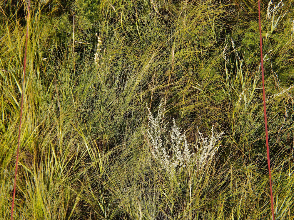
Results: (1) In the survey of grassland plant diversity, the number of species increased as the survey area increased within a certain range. Compared with the artificial ground survey of limited quadrats, more species could be observed using UAV in a large area survey. (2) In the survey of plant diversity in a semi-arid meadow grassland, the spatial resolution of UAV RGB image used for species identification should be better than 0.50 mm, and approximately 67.16% of species could be identified at a resolution of 0.45 mm. In terms of observation angle, it was better to shoot in two ways, which could increase 45° or 60° oblique shooting on the basis of 90° vertical shooting. (3) UAV survey could significantly shorten the time spent in species survey, but high-precision intelligent species identification model should be used to improve the survey efficiency.
Conclusion: By comparing the number of species observed by UAV and traditional artificial ground survey, this study further verifies the feasibility of UAV remote sensing for grassland plant diversity survey, and explores the key parameters of using UAV to obtain visible light images for grassland species survey. The results promote further implementation and prioritization of UAV in grassland monitoring, investigation, and protection.
Key words: grasslands; UAV; plant diversity; method of survey; species recognition
Fengming Wan , Huawei Wan , Zhiru Zhang , Jixi Gao , Chenxi Sun , Yongcai Wang . The application potential of unmanned aerial vehicle surveys in grassland plant diversity[J]. Biodiversity Science, 2024 , 32(3) : 23381 . DOI: 10.17520/biods.2023381
| [1] | Abdel-Rahman E, Makori D, Landmann T, Piiroinen R, Gasim S, Pellikka P, Raina S (2015) The utility of AISA eagle hyperspectral data and random forest classifier for flower mapping. Remote Sensing, 7, 13298-13318. |
| [2] | Alvarez-Vanhard E, Houet T, Mony C, Lecoq L, Corpetti T (2020) Can UAVs fill the gap between in situ surveys and satellites for habitat mapping? Remote Sensing of Environment, 243, 111780. |
| [3] | Alves Oliveira R, Marcato J Jr, Soares Costa C, N?si R, Koivum?ki N, Niemel?inen O, Kaivosoja J, Nyholm L, Pistori H, Honkavaara E (2022) CNN based automated weed detection system using UAV imagery. Silage grass sward nitrogen concentration and dry matter yield estimation using deep regression and RGB images captured by UAV. Agronomy, 12, 1352. |
| [4] | Anul Haq M (2022) CNN based automated weed detection system using UAV imagery. Computer Systems Science and Engineering, 42, 837-849. |
| [5] | Delectis Florae Reipublicae Popularis Sinicae Agendae Academiae Sinicae Edita (1959-2004) Flora Reipublicae Popularis Sinicae (Tomus 1-80). Science Press, Beijing. (in Chinese) |
| [ 中国科学院中国植物志编辑委员会 (1959-2004) 中国植物志(第1-80卷). 科学出版社, 北京.] | |
| [6] | Fang JY, Wang XP, Shen ZH, Tang ZY, He JS, Yu D, Jiang Y, Wang ZH, Zheng CY, Zhu JL, Guo ZD (2009) Methods and protocols for plant community inventory. Biodiversity Science, 17, 533-548. (in Chinese with English abstract) |
| [ 方精云, 王襄平, 沈泽昊, 唐志尧, 贺金生, 于丹, 江源, 王志恒, 郑成洋, 朱江玲, 郭兆迪 (2009) 植物群落清查的主要内容、方法和技术规范. 生物多样性, 17, 533-548.] | |
| [7] | Gallmann J, Schüpbach B, Jacot K, Albrecht M, Winizki J, Kirchgessner N, Aasen H (2022) Flower mapping in grasslands with drones and deep learning. Frontiers in Plant Science, 12, 774965. |
| [8] | Gao JT, Sun FD, Huo F, Zhang LB, Zhou S, Yang TY, Bianbazhaxi (2021) Application and evaluation of unmanned aerial vehicle remote sensing in grassland animal and plant monitoring. Acta Agrestia Sinica, 29, 1-9. (in Chinese with English abstract) |
| [ 高娟婷, 孙飞达, 霍霏, 张履冰, 周俗, 杨廷勇, 边巴扎西 (2021) 无人机遥感技术在草地动植物调查监测中的应用与评价. 草地学报, 29, 1-9.] | |
| [9] | Gómez-Candón D, De Castro AI, López-Granados F (2014) Assessing the accuracy of mosaics from unmanned aerial vehicle (UAV) imagery for precision agriculture purposes in wheat. Precision Agriculture, 15, 44-56. |
| [10] | Guo K, Liu CC, Pan QM (2016) Methods of observing typical plant communities in the Steppe and Desert Biodiversity Observation Network, Sino BON. Biodiversity Science, 24, 1220-1226. (in Chinese with English abstract) |
| [ 郭柯, 刘长成, 潘庆民 (2016) 中国草原/荒漠植物多样性监测网模式植物群落监测方案. 生物多样性, 24, 1220-1226.] | |
| [11] | Hautier Y, Isbell F, Borer ET, Seabloom EW, Harpole WS, Lind EM, MacDougall AS, Stevens CJ, Adler PB, Alberti J, Bakker JD, Brudvig LA, Buckley YM, Cadotte M, Caldeira MC, Chaneton EJ, Chu CJ, Daleo P, Dickman CR, Dwyer JM, Eskelinen A, Fay PA, Firn J, Hagenah N, Hillebrand H, Iribarne O, Kirkman KP, Knops JMH, La Pierre KJ, McCulley RL, Morgan JW, P?rtel M, Pascual J, Price JN, Prober SM, Risch AC, Sankaran M, Schuetz M, Standish RJ, Virtanen R, Wardle GM, Yahdjian L, Hector A (2018) Local loss and spatial homogenization of plant diversity reduce ecosystem multifunctionality. Nature Ecology & Evolution, 2, 50-56. |
| [12] | Hill DJ, Tarasoff C, Whitworth GE, Baron J, Bradshaw JL, Church JS (2016) Utility of unmanned aerial vehicles for mapping invasive plant species: A case study on yellow flag iris (Iris pseudacorus L.). International Journal of Remote Sensing, 38, 2083-2105. |
| [13] | Hung C, Xu Z, Sukkarieh S (2014) Feature learning based approach for weed classification using high resolution aerial images from a digital camera mounted on a UAV. Remote Sensing, 6, 12037-12054. |
| [14] | Jackson J, Lawson CS, Adelmant C, Huhtala E, Fernandes P, Hodgson R, King H, Williamson L, Maseyk K, Hawes N, Hector A, Salguero-Gómez R (2022) Short-range multispectral imaging is an inexpensive, fast, and accurate approach to estimate biodiversity in a temperate calcareous grassland. Ecology and Evolution, 12, e9623. |
| [15] | Jin XL, Liu SY, Baret F, Hemerlé M, Comar A (2017) Estimates of plant density of wheat crops at emergence from very low altitude UAV imagery. Remote Sensing of Environment, 198, 105-114. |
| [16] | Kattenborn T, Eichel J, Fassnacht FE (2019) Convolutional neural networks enable efficient, accurate and fine-grained segmentation of plant species and communities from high-resolution UAV imagery. Scientific Reports, 9, 17656. |
| [17] | Landmann T, Piiroinen R, Makori DM, Abdel-Rahman EM, Makau S, Pellikka P, Raina SK (2015) Application of hyperspectral remote sensing for flower mapping in African savannas. Remote Sensing of Environment, 166, 50-60. |
| [18] | López-Granados F, Torres-Sánchez J, De Castro AI, Serrano-Pérez A, Mesas-Carrascosa FJ, Pe?a JM (2016) Object-based early monitoring of a grass weed in a grass crop using high resolution UAV imagery. Agronomy for Sustainable Development, 36, 67. |
| [19] | Lyu X, Li XB, Dang DL, Dou HS, Wang K, Lou AR (2022) Unmanned aerial vehicle (UAV) remote sensing in grassland ecosystem monitoring: A systematic review. Remote Sensing, 14, 1096. |
| [20] | Mantyka-Pringle CS, Visconti P, Di Marco M, Martin TG, Rondinini C, Rhodes JR (2015) Climate change modifies risk of global biodiversity loss due to land-cover change. Biological Conservation, 187, 103-111. |
| [21] | Martin FM, Müllerová J, Borgniet L, Dommanget F, Breton V, Evette A (2018) Using single- and multi-date UAV and satellite imagery to accurately monitor invasive knotweed species. Remote Sensing, 10, 1662. |
| [22] | Müllerová J, Br?na J, Bartalo? T, Dvo?ák P, Vítková M, Py?ek P (2017) Timing is important: Unmanned aircraft vs. satellite imagery in plant invasion monitoring. Frontiers in Plant Science, 8, 887. |
| [23] | Polley H, Yang CH, Wilsey B, Fay P (2019) Spectral heterogeneity predicts local-scale gamma and beta diversity of mesic grasslands. Remote Sensing, 11, 458. |
| [24] | Qian DW, Du YG, Li Q, Guo XW, Fan B, Cao GM (2022) Impacts of alpine shrub-meadow degradation on its ecosystem services and spatial patterns in Qinghai-Tibetan Plateau. Ecological Indicators, 135, 108541. |
| [25] | Qin Y, Sun Y, Zhang W, Qin Y, Chen JJ, Wang ZW, Zhou ZY (2020) Species monitoring using unmanned aerial vehicle to reveal the ecological role of plateau pika in maintaining vegetation diversity on the Northeastern Qinghai-Tibetan Plateau. Remote Sensing, 12, 2480. |
| [26] | Rossi C, Kneubühler M, Schütz M, Schaepman ME, Haller RM, Risch AC, Disney M, He K (2022) Spatial resolution, spectral metrics and biomass are key aspects in estimating plant species richness from spectral diversity in species-rich grasslands. Remote Sensing in Ecology and Conservation, 8, 297-314. |
| [27] | Sun Y, Qin Y, Wei TF, Chang L, Zhang RP, Liu ZY, Lyu YY, Yi SH (2022) Methods and development trend for the measurement of plant species diversity in grasslands. Chinese Journal of Applied Ecology, 33, 655-663. (in Chinese with English abstract) |
| [ 孙义, 秦彧, 魏天锋, 常丽, 张仁平, 刘志有, 吕燕燕, 宜树华 (2022) 草地植物物种多样性测度方法及发展趋势. 应用生态学报, 33, 655-663.] | |
| [28] | Sun Y, Yi SH, Hou FJ (2018) Unmanned aerial vehicle methods makes species composition monitoring easier in grasslands. Ecological Indicators, 95, 825-830. |
| [29] | Sun Y, Yuan YX, Luo Y, Ji WX, Bian QY, Zhu ZQ, Wang JR, Qin Y, He XZ, Li M, Yi SH (2022) An improved method for monitoring multiscale plant species diversity of alpine grassland using UAV: A case study in the source region of the Yellow River, China. Frontiers in Plant Science, 13, 905715. |
| [30] | Tang ZY, Qiao XJ, Fang JY (2009) Species-area relationship in biological communities. Biodiversity Science, 17, 549-559. (in Chinese with English abstract) |
| [ 唐志尧, 乔秀娟, 方精云 (2009) 生物群落的种-面积关系. 生物多样性, 17, 549-559.] | |
| [31] | Villoslada M, Bergamo TF, Ward RD, Burnside NG, Joyce CB, Bunce RGH, Sepp K (2020) Fine scale plant community assessment in coastal meadows using UAV based multispectral data. Ecological Indicators, 111, 105979. |
| [32] | Wei TF, Shangguan DH, Yi SH, Ding YJ (2021) Characteristics and controls of vegetation and diversity changes monitored with an unmanned aerial vehicle (UAV) in the foreland of the Urumqi Glacier No. 1, Tianshan, China. Science of the Total Environment, 771, 145433. |
| [33] | White TB, Viana LR, Campbell G, Elverum C, Bennun LA (2021) Using technology to improve the management of development impacts on biodiversity. Business Strategy and the Environment, 30, 3502-3516. |
| [34] | Wijesingha J, Astor T, Schulze-Brüninghoff D, Wachendorf M (2020) Mapping invasive Lupinus polyphyllus Lindl. in semi-natural grasslands using object-based image analysis of UAV-borne images. PFG-Journal of Photogrammetry, Remote Sensing and Geoinformation Science, 88, 391-406. |
| [35] | Zhang X, Bao YH, Wang DL, Xin XP, Ding L, Xu DW, Hou LL, Shen J (2021) Using UAV LiDAR to extract vegetation parameters of Inner Mongolian grassland. Remote Sensing, 13, 656. |
| [36] | Zhang XL, Dong SK, Guo XD, Han YH, Li HM, Feng J, Wang C, Liu QR (2015) Comparison of different sampling techniques for alpine grassland plant diversity on Qinghai-Tibet Plateau. Chinese Journal of Ecology, 34, 3568-3574. (in Chinese with English abstract) |
| [ 张晓蕾, 董世魁, 郭贤达, 韩雨晖, 李灏漫, 冯憬, 王琛, 刘全儒 (2015) 青藏高原高寒草地植物多样性调查方法的比较. 生态学杂志, 34, 3568-3574.] | |
| [37] | Zhao YJ, Sun YH, Chen WH, Zhao YP, Liu XL, Bai YF (2021) The potential of mapping grassland plant diversity with the links among spectral diversity, functional trait diversity, and species diversity. Remote Sensing, 13, 3034. |
| [38] | Zheng HB, Zhou X, He JY, Yao X, Cheng T, Zhu Y, Cao WX, Tian YC (2020) Early season detection of rice plants using RGB, NIR-G-B and multispectral images from unmanned aerial vehicle (UAV). Computers and Electronics in Agriculture, 169, 105223. |
/
| 〈 |
|
〉 |
Copyright © 2026 Biodiversity Science
Editorial Office of Biodiversity Science, 20 Nanxincun, Xiangshan, Beijing 100093, China
Tel: 010-62836137, 62836665 E-mail: biodiversity@ibcas.ac.cn
