)
)
)
)
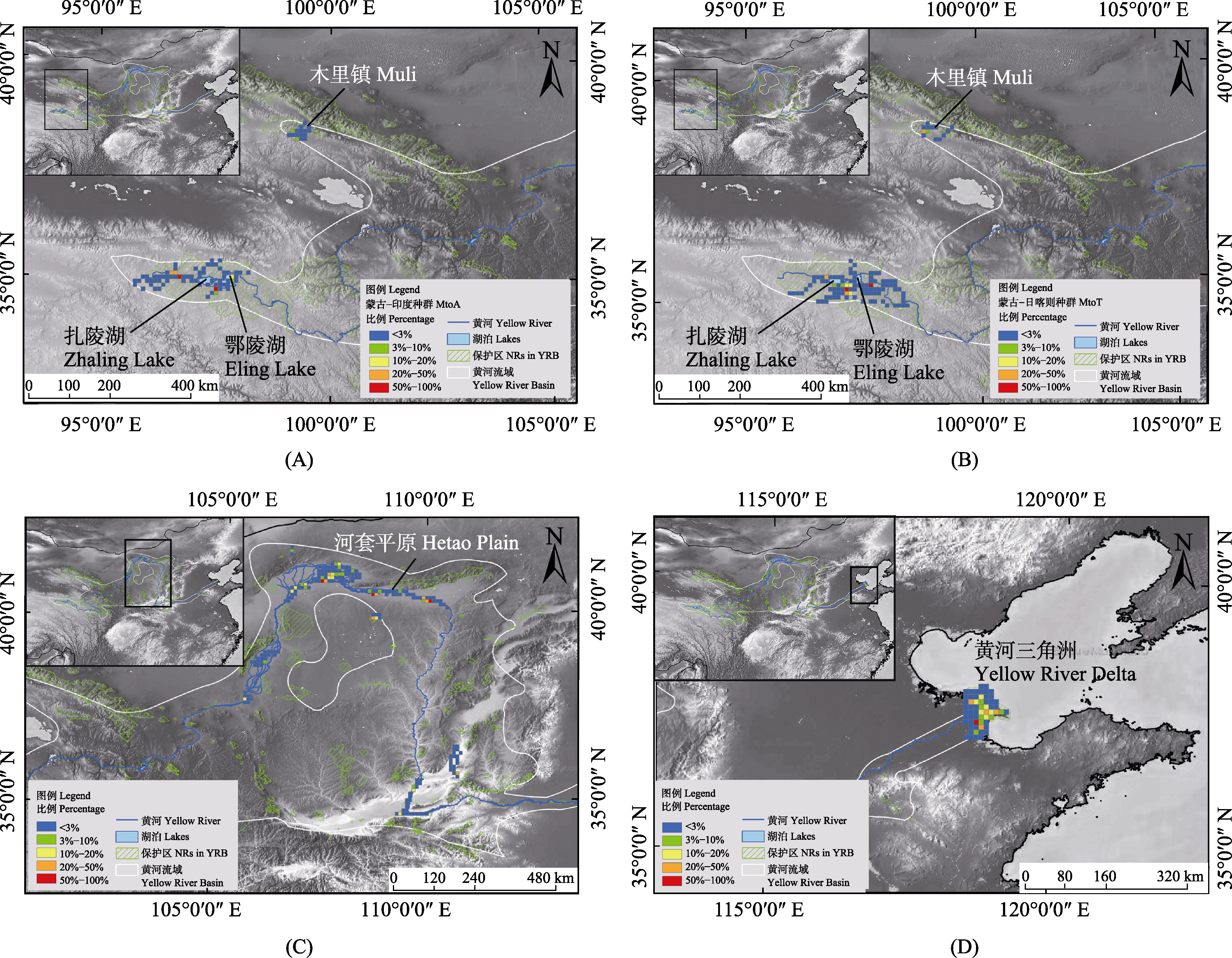
图2. 3种水鸟在黄河流域活动位点的密度分析图。(A)和(B)分别为斑头雁MtoT (蒙古国-中国日喀则)种群和MtoA (蒙古国-印度/孟加拉国)种群在黄河流域内的重要栖息地; (C)白琵鹭蒙古-长江种群在黄河流域内的重要栖息地; (D)东方白鹳黑龙江繁殖种群在黄河流域的重要栖息地。蓝线为黄河, 白线为黄河流域边界, 绿色网格阴影区域为黄河流域自然保护区范围。黄河流域的位点密度使用3% (蓝)、3%?10% (绿)、10%?20% (黄)、20%?50% (橙)与50?100% (红)进行分级标注(
Fig. 2. Density diagram of the sites of three waterbirds in the Yellow River basin. (A) and (B) showed the important habitats of the MtoT population and the MtoA population of the Bar-headed Goose; (C) showed the important habitat of the Eurasian Spoonbill; (D) showed the important habitat of the Oriental Stork. The blue line is the Yellow River, the white line is the boundary of the Yellow River basin, and the area shaded by the green grid is the Yellow River basin nature reserves. The site density of the Yellow River basin is marked with 3% (blue), 3%?10% (green), 10%?20% (yellow), 20%?50% (orange) and 50%?100% (red) (