)
)
)
)
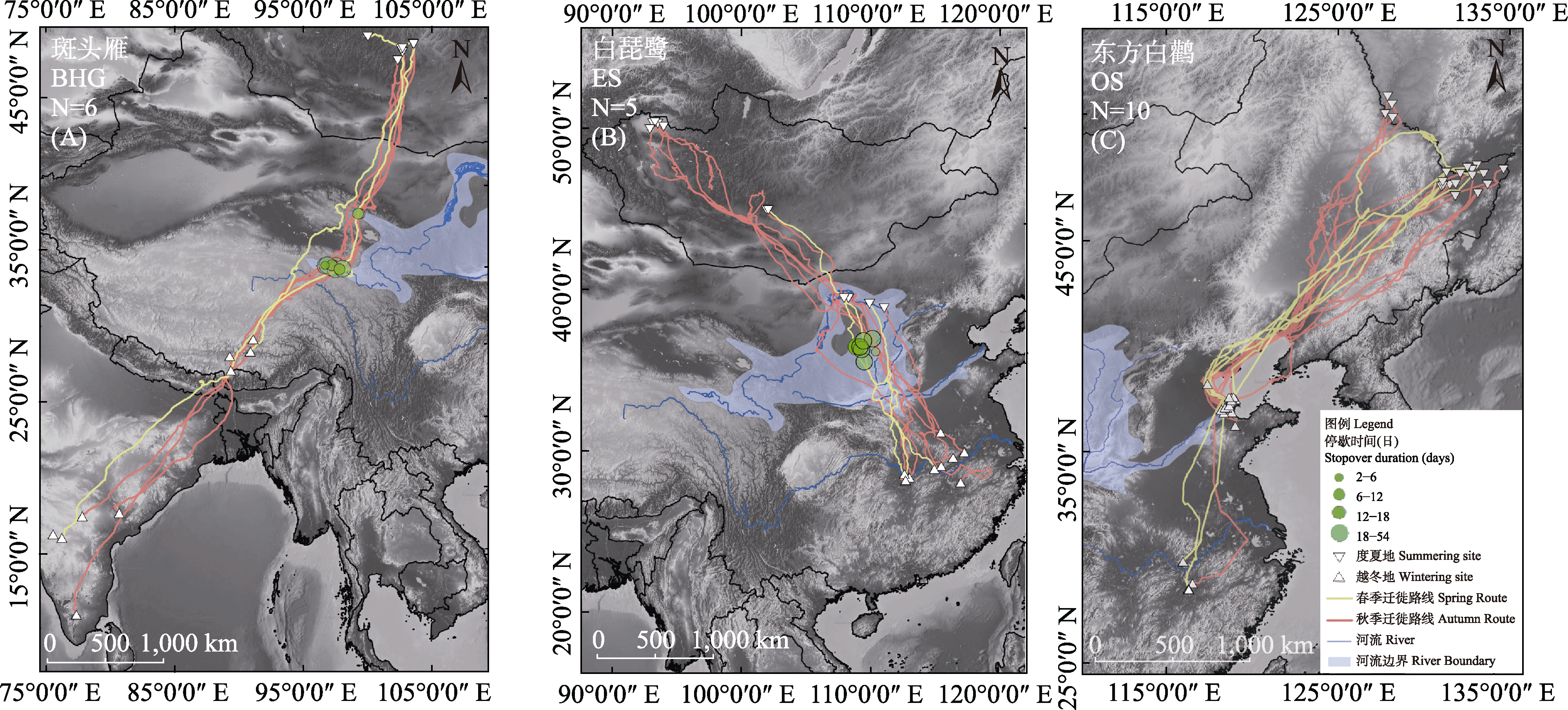
图1. 追踪的3种水鸟的迁徙路线图。(A) 6只斑头雁的春秋迁徙路线: 繁殖地位于蒙古国, 越冬地在中国西藏日喀则与印度/孟加拉国, 迁徙过程中主要在黄河流域停歇。(B) 5只白琵鹭的春秋迁徙路线: 繁殖地在蒙古国, 越冬地在长江中下游流域, 迁徙中在黄河流域停歇或度夏。(C) 10只东方白鹳的春秋迁徙路线: 在黄河流域越冬。红线代表秋季迁徙路线, 黄线代表春季迁徙路线, 倒三角表示度夏位点, 正三角表示越冬位点, 绿色圆圈代表迁徙过程在黄河流域的停歇地与停歇时长, 蓝线代表黄河与长江, 浅蓝色阴影代表黄河流域(
Fig. 1. The map of the migration route of three waterbirds by tracking their life history. (A) The spring and autumn migration routes of 6 Bar-headed Geese. The breeding area is Mongolia, and the wintering areas are Shigatse of Tibet of China and India/Bangladesh. The Species mainly stops in the Yellow River basin. (B) The spring and autumn migration routes of 5 Eurasian Spoonbills. The breeding area is Mongolia, the wintering area is the middle and lower reaches of the Yangtze River, and it stops or spends summer in the Yellow River basin during migration. (C) The spring and autumn migration routes of 10 Oriental Storks, overwintering in the Yellow River basin. The red line represents the autumn migration route, the yellow line represents the spring migration route, the inverted triangle represents the summering sites, the forward triangle represents the wintering sites, the green circle represents the location and period of the stopover in the Yellow River basin, the blue line represents the Yellow River and the Yangtze River and the light blue shadow represents the Yellow River basin (